")
")
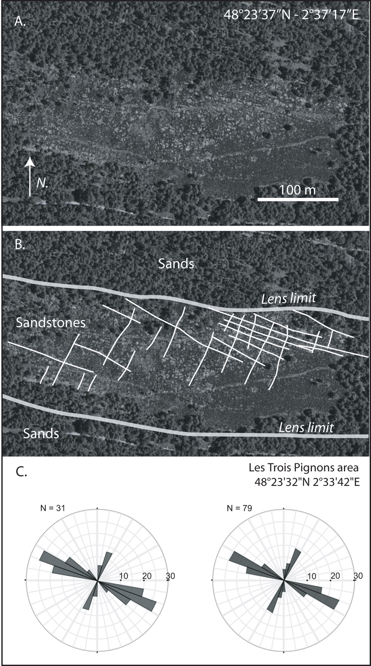
Fig. 8
Download original image
Aerial picture (Google Earth©) of a sandstone lens in the Fontainebleau area (Location Fig. 1). The sandstone lens forms a plateau (also called “platière”) surrounded by valleys in the sands. A. Raw picture and coordinates. B. Highlight of the lens limit and fracture pattern (white lines). The main joints direction is N120°, oblique to the N100° lens limit, discarding gravitational origin of the fractures. The secondary N25° joint set is also highlighted. C. Two rose diagrams of fracture orientations in the Fontainebleau area published by Obert (1984) – N: number of data.
Current usage metrics show cumulative count of Article Views (full-text article views including HTML views, PDF and ePub downloads, according to the available data) and Abstracts Views on Vision4Press platform.
Data correspond to usage on the plateform after 2015. The current usage metrics is available 48-96 hours after online publication and is updated daily on week days.
Initial download of the metrics may take a while.