Fig. 4

Download original image
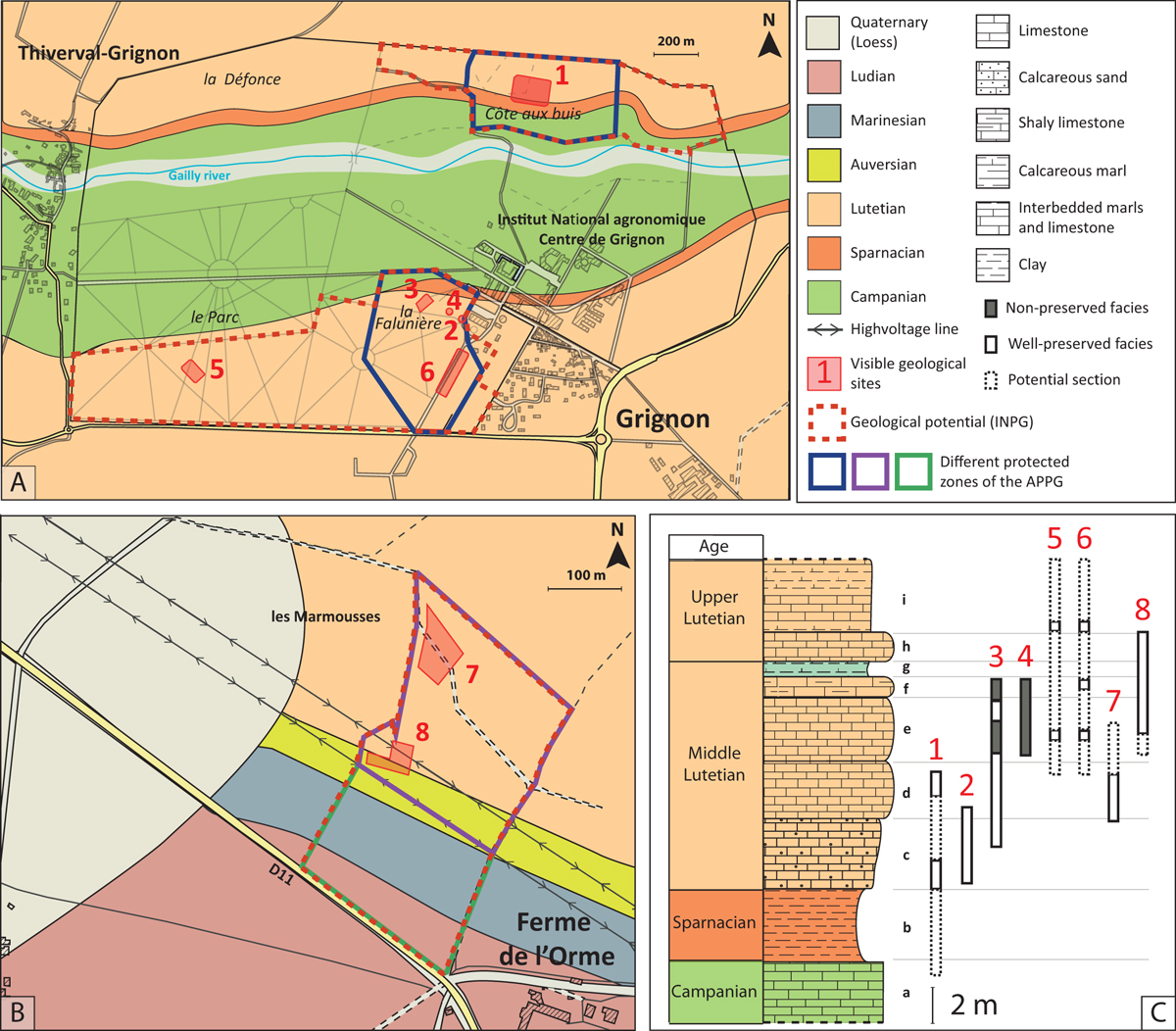
The location and distribution of visible geological sites of Grignon and the Ferme de l’Orme on their geological map and correlated section. A. In Grignon, the protected zone of the APPG is highly reduced compared to the geological potential defined by the INPG (map adapted from Merle et al., 2016). B. In the Ferme de l’Orme, two types of areas with different protective measures were defined in order to facilitate the negotiation of the APPG. In the purple area it is forbidden to excavate beyond 1 m, whereas in the green area it is authorised up to 4 m. All other regulatory measures apply to both areas. C. The well-preserved sections outcropping in the sites of the Ferme de l’Orme and Grignon complement each other, which highlights their stratigraphic interest. A-1) The Côte-aux-Buis, 2) Old galleries, 3) The Falunière, 4) The Riding hall, 5) The Parc, 6) The Maugère, B-7) Edge of the forest, 8) The quarry. C-a) The Craie à Silex, b) Argiles plastiques, c) Bed with Campanile giganteum, d) Bed with Milioles and Orbitolites, e) Bed with Avicularium lithocardium and some plants, f) Bed with Potamides and Batillaria, g) Green marls with Lymnea and Staliola, equivalent of the “Banc Vert” of Paris, h) Bed with Sigmesalia, i) Marnes et caillasses.
Current usage metrics show cumulative count of Article Views (full-text article views including HTML views, PDF and ePub downloads, according to the available data) and Abstracts Views on Vision4Press platform.
Data correspond to usage on the plateform after 2015. The current usage metrics is available 48-96 hours after online publication and is updated daily on week days.
Initial download of the metrics may take a while.


