")
")
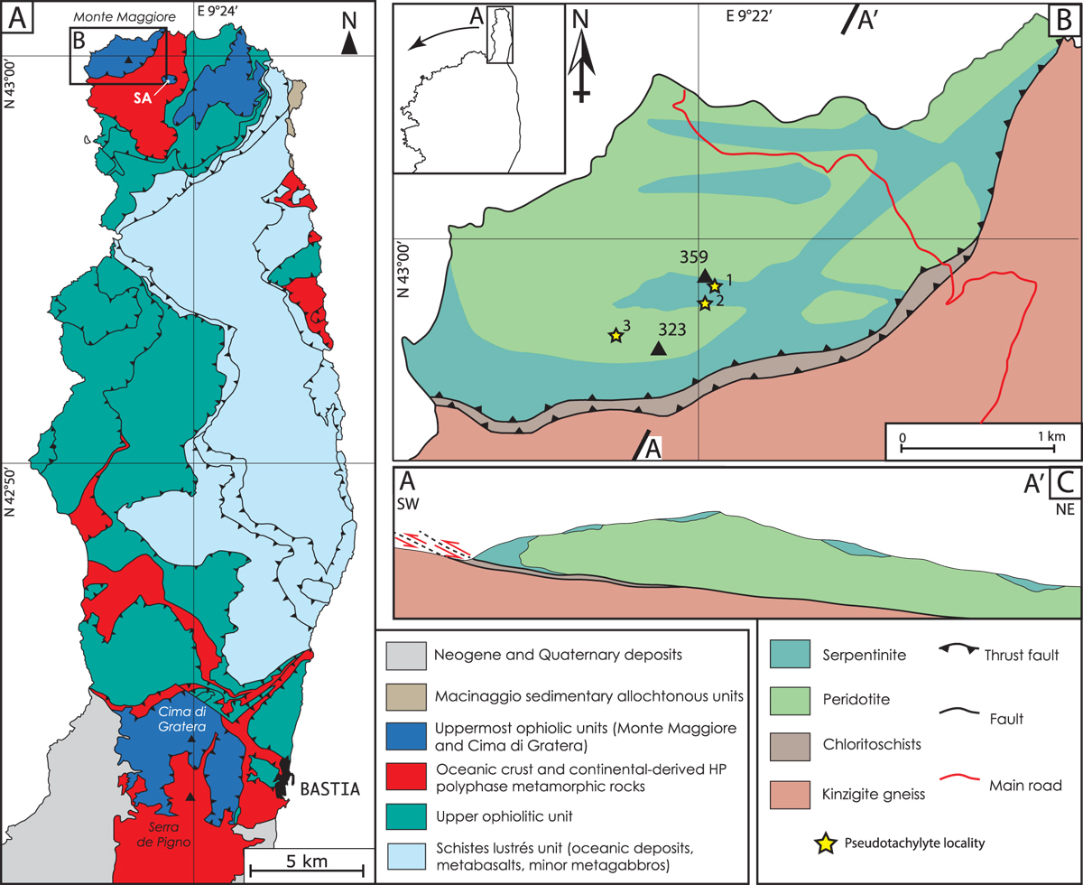
Fig. 1
Download original image
A. Structural sketch map of Cape Corse peninsula showing the location of Monte Maggiore and Cima di Gratera ophiolitic units (modified after Lahondère and Lahondère 1988, 1992). SA is Sant’Antonino klippe. B. Geological sketch map of the Monte Maggiore klippe with pseudotachylyte localities. C. A-A’ cross-section (see location on B).
Current usage metrics show cumulative count of Article Views (full-text article views including HTML views, PDF and ePub downloads, according to the available data) and Abstracts Views on Vision4Press platform.
Data correspond to usage on the plateform after 2015. The current usage metrics is available 48-96 hours after online publication and is updated daily on week days.
Initial download of the metrics may take a while.