Fig. 4

Download original image
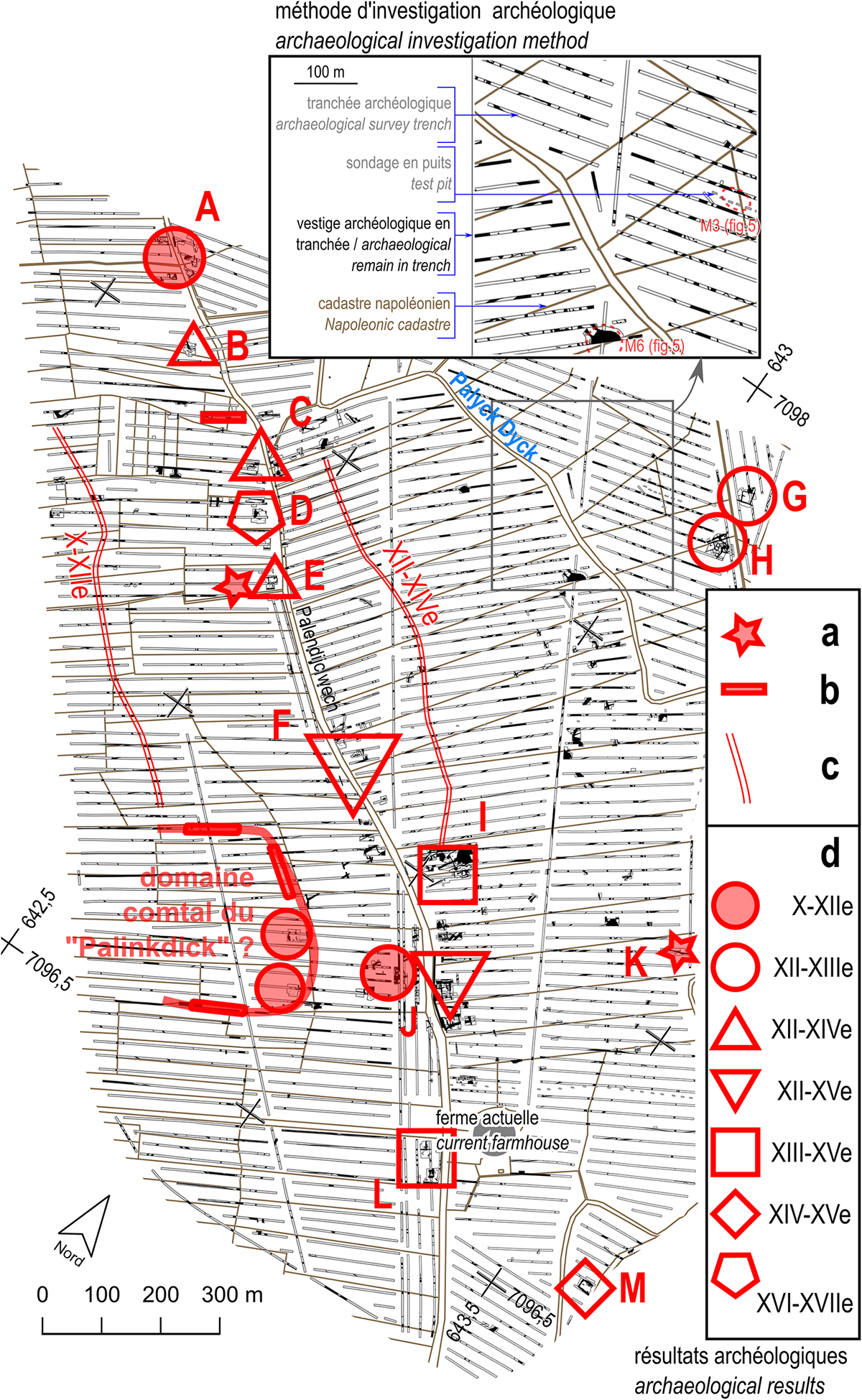
Principaux ensembles archéologiques détectés et attribution chronologique. Fond de plan : parcelles d’après le cadastre « napoléonien ». a : fossé barrant un chenal (Xe–XIIe siècles en E, IXe–XIIe siècles en K) ; b : structure ou niveau archéologique associé à un chenal ; c : long fossé double ; d : habitat et attribution chronologique.
Main archaeological sets detected and their chronological attribution. Basemap: the “Napoleonic” cadastre. a: ditch obstruting a channel (X–XIIth centuries in E, IX–XIIth centuries in K); b: archaeological structure or level associated with a channel; c: long double; d: habitat and chronological attribution.
Current usage metrics show cumulative count of Article Views (full-text article views including HTML views, PDF and ePub downloads, according to the available data) and Abstracts Views on Vision4Press platform.
Data correspond to usage on the plateform after 2015. The current usage metrics is available 48-96 hours after online publication and is updated daily on week days.
Initial download of the metrics may take a while.


