Fig. 5

Download original image
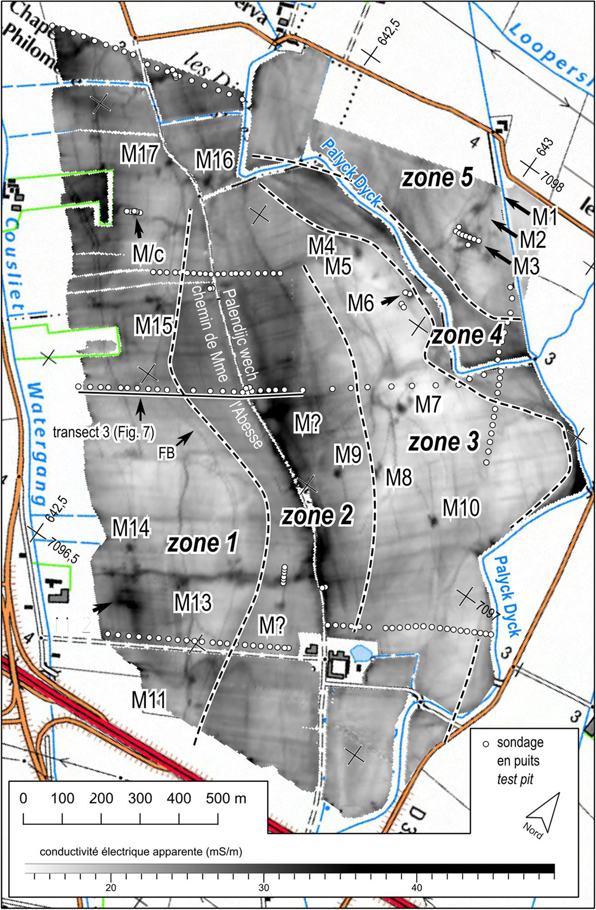
Carte de conductivité apparente EM31 mode VCP et localisation des observations de la stratigraphie holocène. Sur un extrait de la carte IGN 1/25 000, coordonnées en km Lambert 93. Distinction de 5 zones paléogéographiques en fonctions de la stratigraphie, de la conductivité, de la présence d’hydrobies et des vestiges archéologiques, M = mares ; M/c = probable mare érodée par un chenal de marée ; FB : fossé bordier de la limite zone 1–2.
Apparent conductivity map EM31 VCP mode and location of Holocene stratigraphy observations. Overlaying an extract of the 1/25 000 IGN map, Lambert 93 survey Distinction of 5 palaeogeographic zones on the basis of stratigraphy, conductivity, presence of hydrobias and archaeological remains; M = ponds; M/c = probable pond eroded by a tidal channel; FB: ditch bordering the zone 1–2 boundary.
Current usage metrics show cumulative count of Article Views (full-text article views including HTML views, PDF and ePub downloads, according to the available data) and Abstracts Views on Vision4Press platform.
Data correspond to usage on the plateform after 2015. The current usage metrics is available 48-96 hours after online publication and is updated daily on week days.
Initial download of the metrics may take a while.


