Fig. 8

Download original image
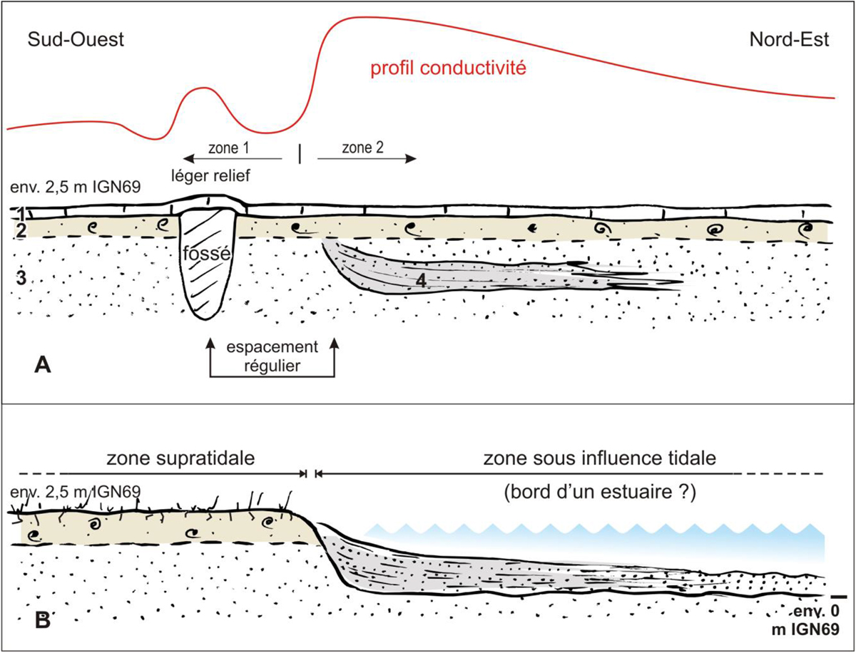
Limite entre les zones 1 et 2 selon le transect lithostratigraphique no3 et hypothèse de la bordure d’estuaire contemporaine de la fixation du parcellaire de la zone 1. A : état actuel ; B : état passé, bordure de l’estuaire actif ; 1 : labour ; 2 : schorre ; 3 : sable ; 4 : sable argileux lité.
Limit between zones 1 and 2 according to lithostratigraphic transect no3 and hypothesis of the contemporary estuary border of the fixation of the zone 1 plots. A: current state; B: past state, edge of active estuary; 1: plowing; 2: schorre; 3: sand; 4: bedded clayed sand.
Current usage metrics show cumulative count of Article Views (full-text article views including HTML views, PDF and ePub downloads, according to the available data) and Abstracts Views on Vision4Press platform.
Data correspond to usage on the plateform after 2015. The current usage metrics is available 48-96 hours after online publication and is updated daily on week days.
Initial download of the metrics may take a while.


