")
")
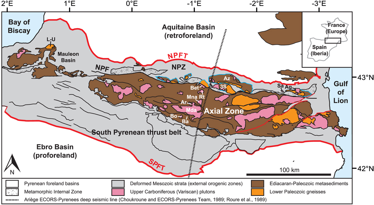
Fig. 6
Download original image
Simplified tectonic map of the Pyrenees showing the main tectonic units and the location of (i) the North Pyrenean basement massifs and (ii) the plutons/gneiss domes in the Axial Zone that are mentioned in the text (Choukroune and ECORS-Pyrenees Team, 1989; Roure et al., 1989). NPFT = North Pyrenean Frontal Thrust; NPZ = North Pyrenean Zone; NPF = North Pyrenean Fault; SPFT = South Pyrenean Fault. (i) L-U = Labourd-Ursuya; Ar = Arize; TS = Trois-Seigneurs; Ag = Agly; Sa = Salvezines. (ii) Bet = Bethmale; Rt = Riberot; Mna = Marimaña; Mda = Maladeta; Ba = Barruera; Bo = Bono. Modified after Ternois et al. (2019a).
Current usage metrics show cumulative count of Article Views (full-text article views including HTML views, PDF and ePub downloads, according to the available data) and Abstracts Views on Vision4Press platform.
Data correspond to usage on the plateform after 2015. The current usage metrics is available 48-96 hours after online publication and is updated daily on week days.
Initial download of the metrics may take a while.