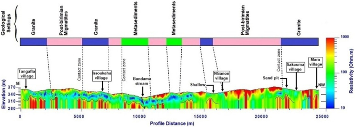
Fig. 8

Download original image
Pseudo 2D resistivity section with main geological features. The black dashed line corresponds to the bottom of the indured saprolite. The saprolite and fissured zone layers are contained within the blue to green horizons. The solid black line is the interface between the fissured-rock zone and the basement. The red dashed lines indicate extrapolated tectonic faults.
Current usage metrics show cumulative count of Article Views (full-text article views including HTML views, PDF and ePub downloads, according to the available data) and Abstracts Views on Vision4Press platform.
Data correspond to usage on the plateform after 2015. The current usage metrics is available 48-96 hours after online publication and is updated daily on week days.
Initial download of the metrics may take a while.


