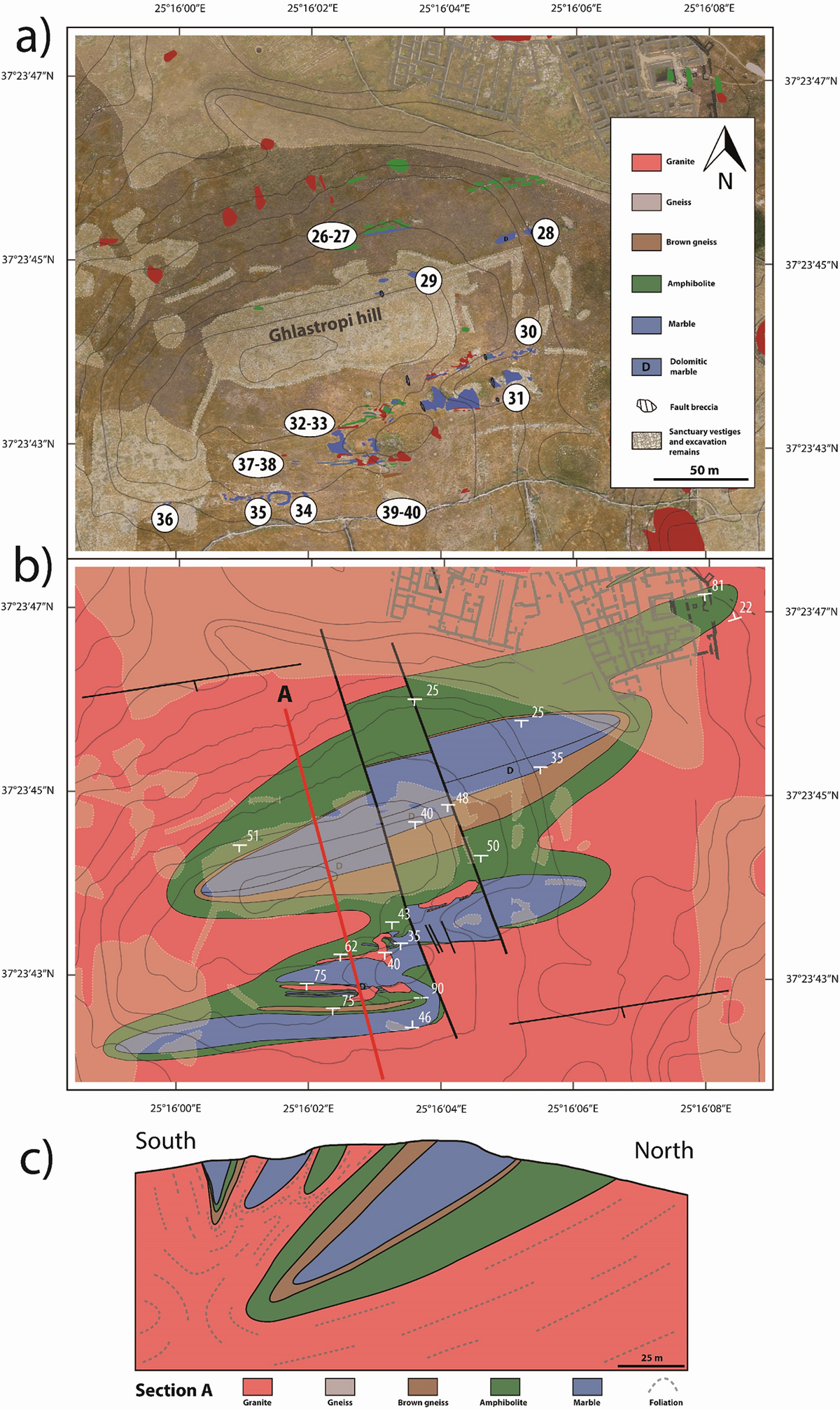
Fig. 5

Download original image
(a) Location of the lithological outcrops and marble samples (no 26 to no 40) on the satellite map of the Ghlastropi hill quarry C24. The beige colour shows the areas covered by ruins or excavation debris, making the outcrops inaccessible; (b) 5000th scale geological map of the quarry C24. The red line locate the cross section A described below; (c) Cross section A located in quarry C24.
Current usage metrics show cumulative count of Article Views (full-text article views including HTML views, PDF and ePub downloads, according to the available data) and Abstracts Views on Vision4Press platform.
Data correspond to usage on the plateform after 2015. The current usage metrics is available 48-96 hours after online publication and is updated daily on week days.
Initial download of the metrics may take a while.


