")
")
Fig. 2
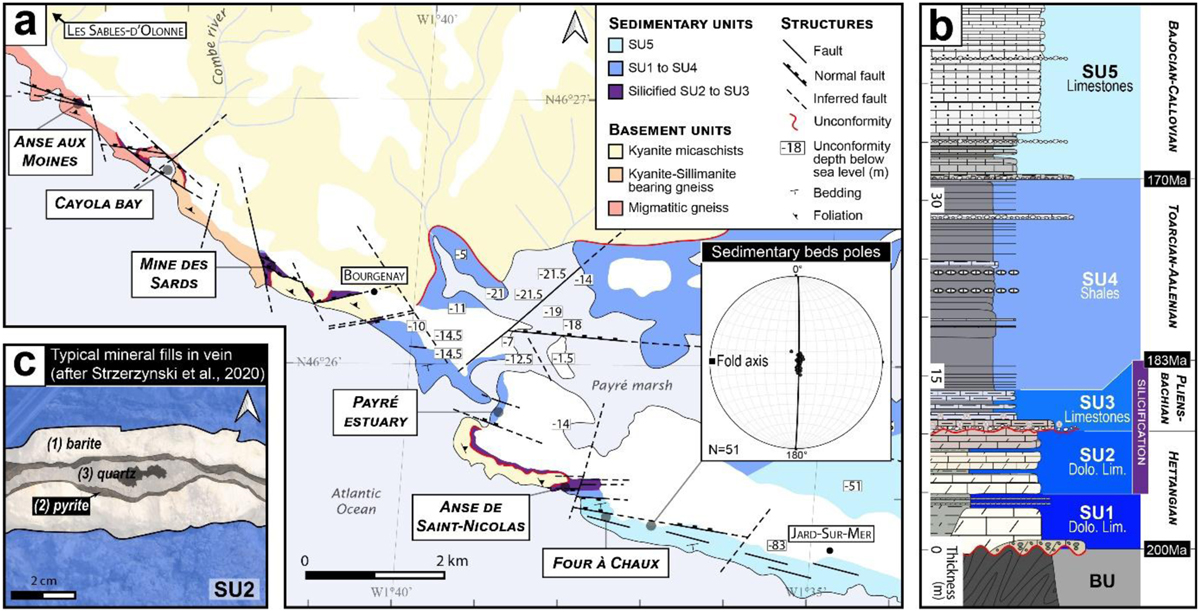
Download original image
(a) Geological map of the Vendée coastal domain modified after Ters and Gabilly (1986) based on field observations with close attention on faults shifting the unconformity and unconformity depth (B.S.L.: Below Sea Level) compiled after B.R.G.M. database (B.S.S. n.d.). (b) Simplified geological log from Strzerzynski et al. (2020). Dolo. Lim.: Dolomitic limestones (c) Pattern of vein paragenesis after Strzerzynski et al. (2020).
Current usage metrics show cumulative count of Article Views (full-text article views including HTML views, PDF and ePub downloads, according to the available data) and Abstracts Views on Vision4Press platform.
Data correspond to usage on the plateform after 2015. The current usage metrics is available 48-96 hours after online publication and is updated daily on week days.
Initial download of the metrics may take a while.