")
")
Fig. 8
Download original image
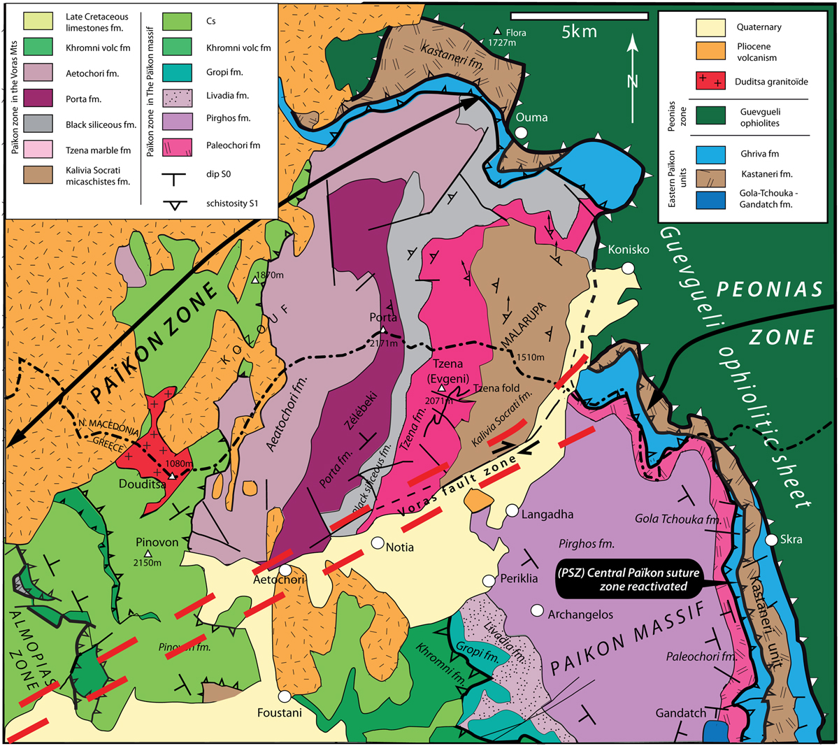
(A) Geological sketch of the Paikon zone in the Voras Tzena Mts (north of the Aridhea Almopias Plain). Same symbols as on Fig. 4B. The Paikon Massif is separated from the Tzena-Malarupa Massif by the dextral strike-slip Voras fault zone superimposed upon a Jurassic probably oceanic transform fault (see text). (B) Structural sketch of the southern Paikon Massif (drawn from Jannitsa geol. sheet, Mercier et al., 2005). Same symbols as on Figure 4B; −ster. A1: NNW-SSE striking (B1) fold axes with a western vergence affecting the Pirghos fm. at the Megha Rema (A1-A2), site (D1 event); −ster. A2: NE-SW (B2) fold axes with an eastern vergence refolding the B1 folds. It is important to underline that the small B1 folds are numerous in the reverse limbs of the B2 large folds (cartoons on Fig. 9). Thus, being inverted, their apparent dissymmetry may wrongly suggest that the B1 folds (D1 event) have an eastern vergence; −ster. A3: vergence of the folds of D3 and D4 events, striking ∼NW-SE and ∼W-E, respectively, indicated on figure by arrows with green and green-yellow arrow heads, respectively; ster. A4: axes of the folds of the D3 and D4 events. Section I in southern Paikon (see Fig. 9); Section II, double line in N. Paikon shows the thrust of the Kastaneri unit upon the Late Cretaceous Gola Tchouka unit, the Gandatch Late Cretaceous syncline is probably a Gola Tchouka klippe re-folded.
Current usage metrics show cumulative count of Article Views (full-text article views including HTML views, PDF and ePub downloads, according to the available data) and Abstracts Views on Vision4Press platform.
Data correspond to usage on the plateform after 2015. The current usage metrics is available 48-96 hours after online publication and is updated daily on week days.
Initial download of the metrics may take a while.