")
")
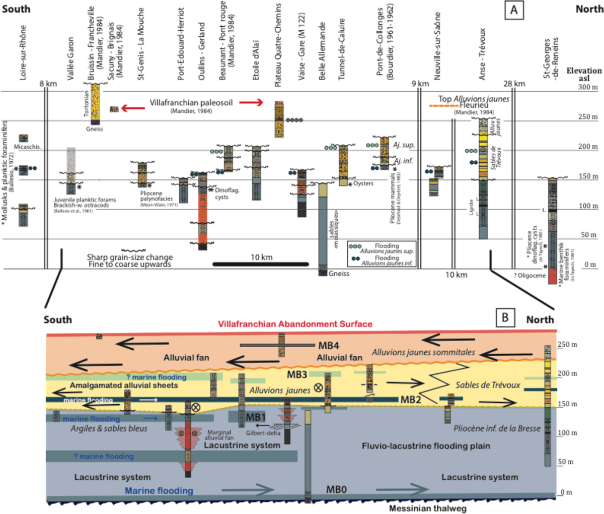
Fig. 7
Download original image
Pliocene stratigraphy from boreholes and outcrops through the profile following the main axis of the ria. It illustrates the landward stepping of the successive marine floodings, i.e., MB0, MB1, and MB2 Marker-Bands. The fact that MB2 and MB3 can be followed all along the meridian stratigraphic profile proves that the south to north Alluvions jaunes to Sables de Trévoux lithologic change is due to lateral facies change. The much more restricted extent of MB4 migt be apparent only, due to scarcity of borehole data. Site locations are available in Figures 1 and 2.
Stratigraphie du Pliocène dans l’axe principal de la ria d’après forages et affleurements, illustrant l’expansion dans les terres des ennoiements marins successifs.
Current usage metrics show cumulative count of Article Views (full-text article views including HTML views, PDF and ePub downloads, according to the available data) and Abstracts Views on Vision4Press platform.
Data correspond to usage on the plateform after 2015. The current usage metrics is available 48-96 hours after online publication and is updated daily on week days.
Initial download of the metrics may take a while.