")
")
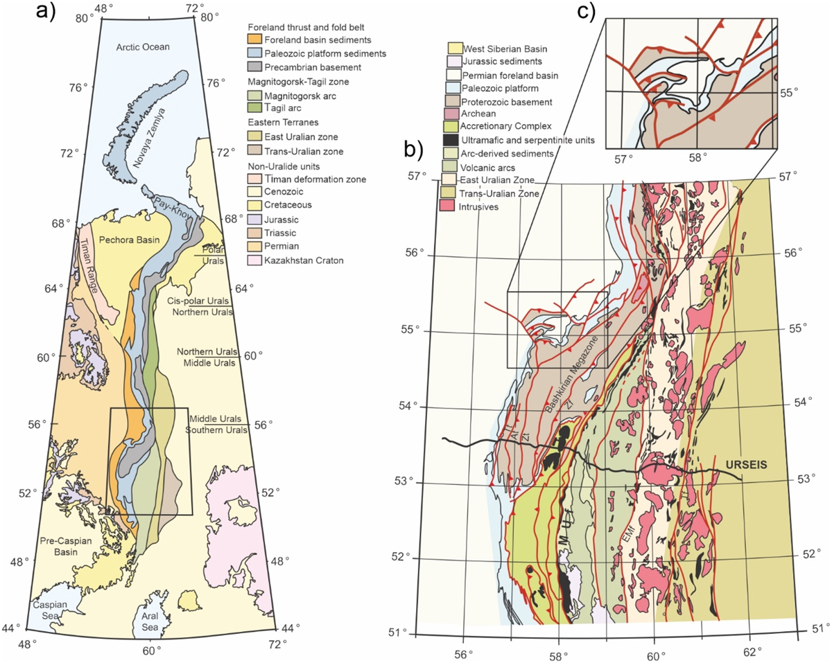
Fig. 1
Download original image
Map showing the different zones of the Urals and its geographic divisions (a). Geological map of the Southern and part of the Middle Urals showing the location of the URSEIS seismic profile (b). Main faults are: Tt − Tashly thrust, At − Alatau thrust, Zt − Zilmerdak thrust, Zf − Zuratkul fault, MUf − Main Uralian fault, Emf − East Magnitogorsk fault, Tf − Troisk fault. The box (c) indicates the area discussed in this paper (Adapted from Brown et al., 2011).
Carte montrant les différentes zones de l’Oural et ses divisions géographiques (a). Carte géologique de l’Oural du Sud et d’une partie de l’Oural Moyen montrant l’emplacement du profil sismique URSEIS (b). L’encadré (c) indique la zone discutée dans cet article.
Current usage metrics show cumulative count of Article Views (full-text article views including HTML views, PDF and ePub downloads, according to the available data) and Abstracts Views on Vision4Press platform.
Data correspond to usage on the plateform after 2015. The current usage metrics is available 48-96 hours after online publication and is updated daily on week days.
Initial download of the metrics may take a while.