")
")
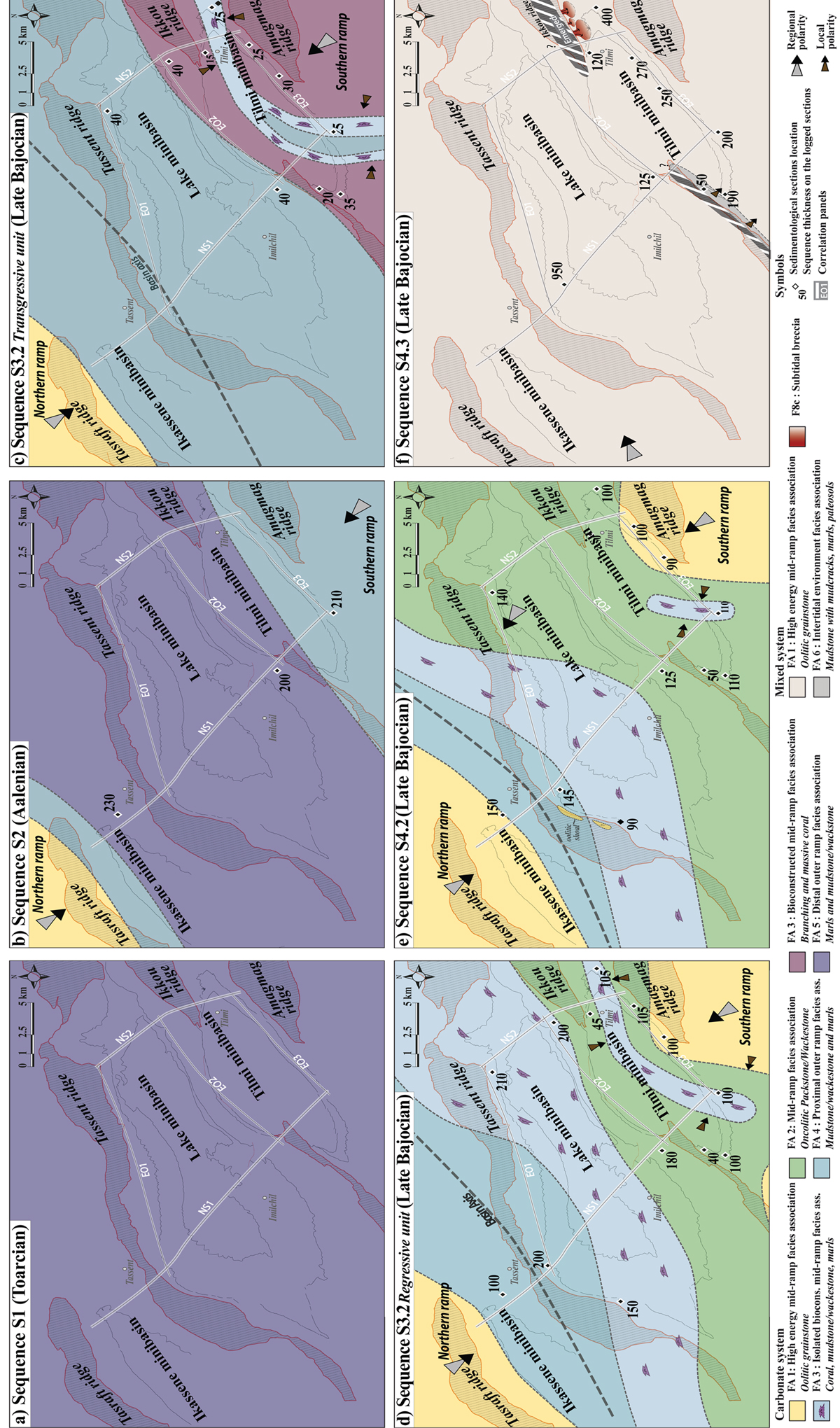
Fig. 9
Download original image
Paleographic sketch maps showing the main depositional environments during sequence S1 (a), sequence S2 (b), the transgressive unit of sequence S3.2 (c), the regressive unit of sequence S3.2 (d), sequence S4.2 (e), sequence S4.3 (f). The available data for sequence S4.3 give information about the facies only in the south of the Ikkou ridge, they do not provide any evidence concerning the emersion of the other diapiric ridges (Tassent and Amagmag) at this time. Note that the correlation transects used to construct these maps are represented in white.
Current usage metrics show cumulative count of Article Views (full-text article views including HTML views, PDF and ePub downloads, according to the available data) and Abstracts Views on Vision4Press platform.
Data correspond to usage on the plateform after 2015. The current usage metrics is available 48-96 hours after online publication and is updated daily on week days.
Initial download of the metrics may take a while.