")
")
Fig. 10
Download original image
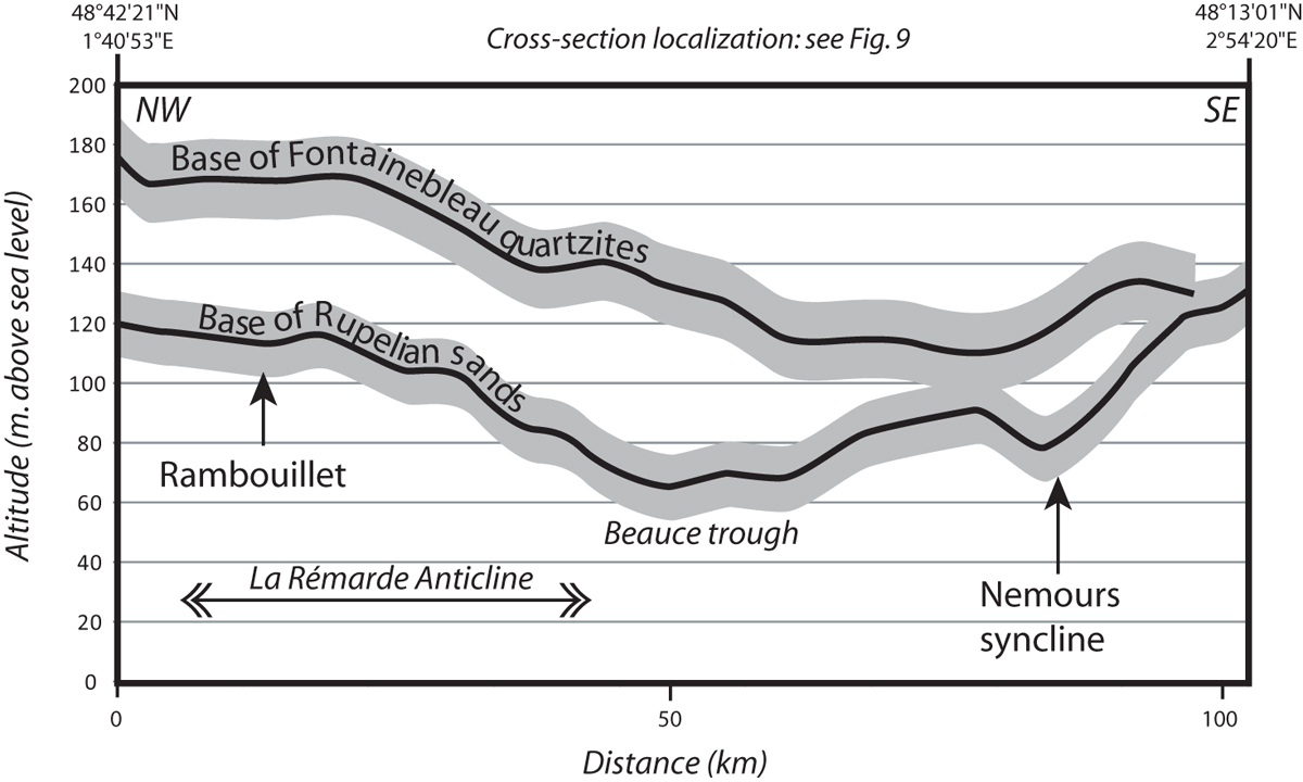
NNW-SSE cross-section through the Rémarde Anticline and the Beauce trough (location Fig. 9) showing the geometry of the base of Fontainebleau Sand Formation and the base of the Fontainebleau quartzite. The main altitude variations related to the La Rémarde Anticline and Beauce trough are similar for both curves – even if considering an uncertainty of ±10 m (grey area) – indicating that both surfaces are folded together. Curves merge in the eastern part as the thickness of the Fontainebleau sands decrease until complete disappearance of the formation (Rupelian basin border).
Current usage metrics show cumulative count of Article Views (full-text article views including HTML views, PDF and ePub downloads, according to the available data) and Abstracts Views on Vision4Press platform.
Data correspond to usage on the plateform after 2015. The current usage metrics is available 48-96 hours after online publication and is updated daily on week days.
Initial download of the metrics may take a while.