")
")
Fig. 6
Download original image
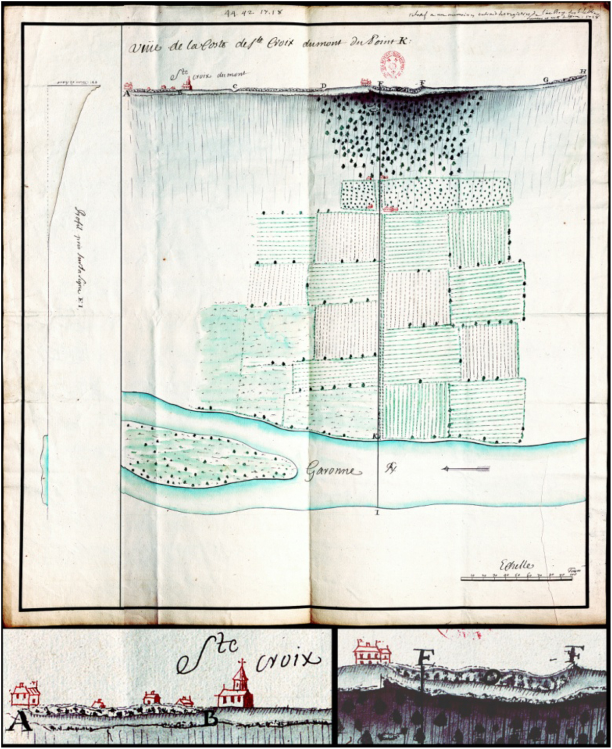
Map and perspective view by Barrelier de Bitry (1718), 51.5 cm × 53.5 cm at a scale of 9.4 cm per 100 “toises” (ca. 1: 2100; 1 toise ≈ 1.95 m), with topographic profile (left) from the River Garonne (I) to Loubens (E); details of the cliff at Sainte-Croix-du-Mont (bottom left) and Loubens (bottom right) are shown (©Bibliothèque de l’Institut; see Appendix A3.5). The cliff is represented from the castle (A) to its SE edge (H), with a mottled pattern indicating the oyster-rich level (e.g., between C and D). The letters refer to a missing memoir; A: castle; B: church; C: ravine (?); D, E, F: Loubens; "O": troglodyte chapel; K: access to “allée des pins", where Louis XIII landed in 1620.
Current usage metrics show cumulative count of Article Views (full-text article views including HTML views, PDF and ePub downloads, according to the available data) and Abstracts Views on Vision4Press platform.
Data correspond to usage on the plateform after 2015. The current usage metrics is available 48-96 hours after online publication and is updated daily on week days.
Initial download of the metrics may take a while.