")
")
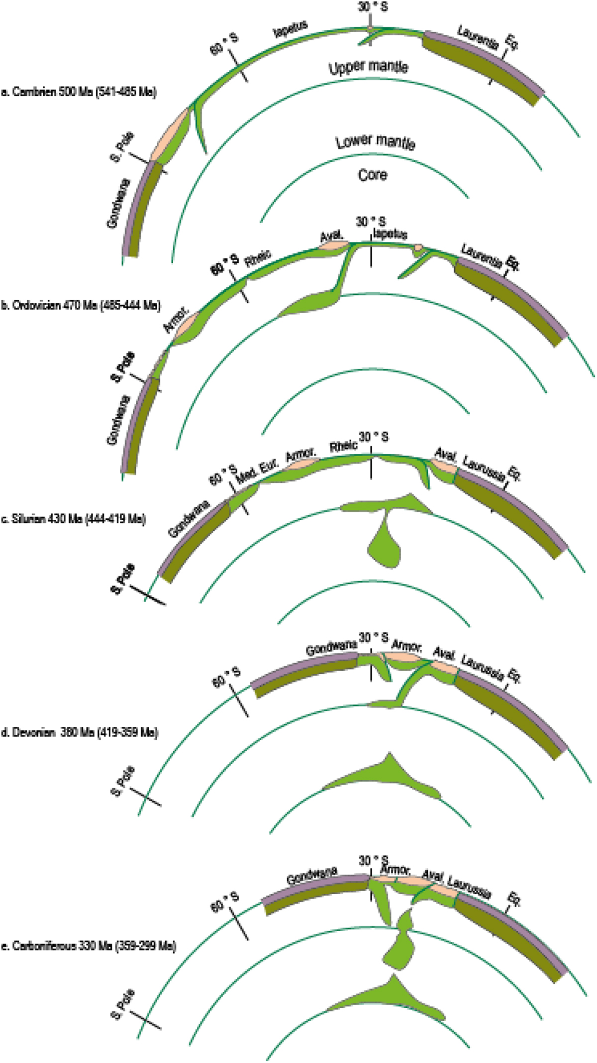
Fig. 17
Download original image
Plate scale geodynamic reconstruction for the Paleozoic (modified after Domeier, 2016; Domeier and Torsvik, 2014; Matte, 2001). A. Cambrian 500 Ma (541–485 Ma). The Gondwana margin is at the South Pole, Laurentia is at the Equator and the Iapetus Ocean is at least 3000 km wide. The Gondwana margin is an active plate boundary marked by subduction of the Iapetus. B. Ordovician 470 Ma (485–444 Ma). The margin of Gondwana is marked by hyperextension resulting in the separation of Avalonia and Armorica and the opening of the Rheic and Medio-European Oceans. C. Silurian 430 Ma (444–419 Ma). The Iapetus Ocean has closed and Avalonia has been tectonically accreted to Laurussia. The Rheic Ocean started to subduct beneath the margin of Laurussia and Medio-European Ocean, between Armorica and Gondwana is at its maximum width. D. Devonian 380 Ma (419–359 Ma). Armorica is bounded by subduction zones with opposite vergence resulting in the formation of the Variscan belt. E. Carboniferous 330 Ma (359–299 Ma). The Variscan orogenic front progresses from the hinterland to the foreland in association with slab retreat.
Current usage metrics show cumulative count of Article Views (full-text article views including HTML views, PDF and ePub downloads, according to the available data) and Abstracts Views on Vision4Press platform.
Data correspond to usage on the plateform after 2015. The current usage metrics is available 48-96 hours after online publication and is updated daily on week days.
Initial download of the metrics may take a while.