")
")
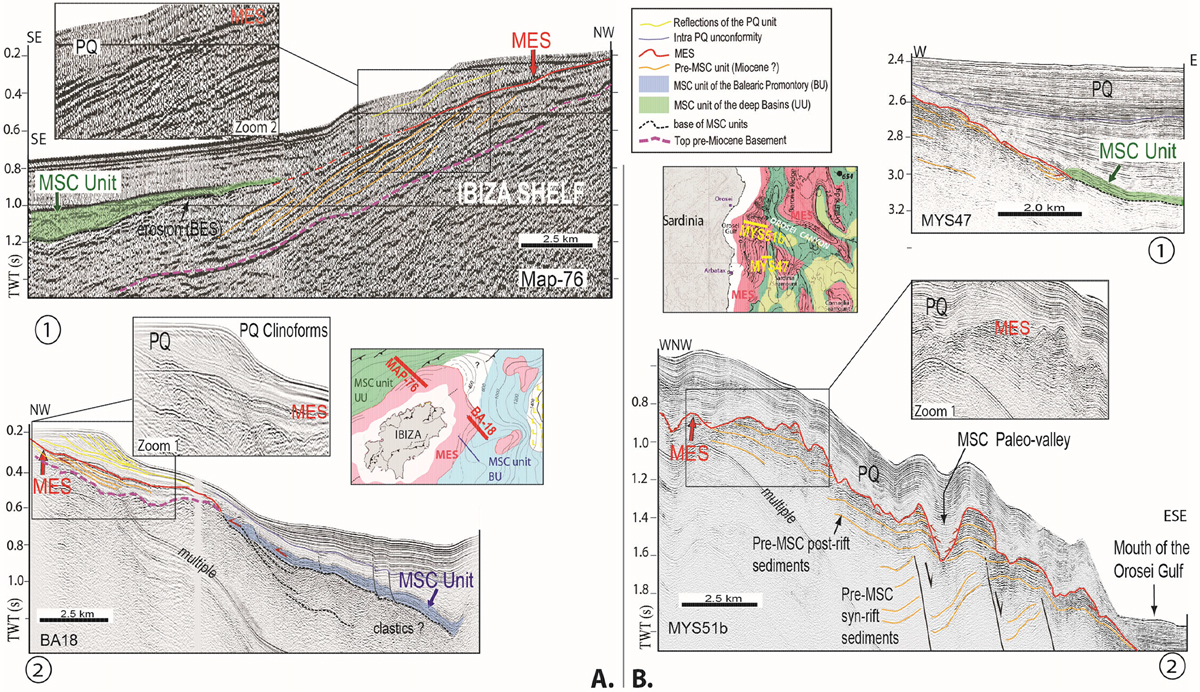
Fig. 3
Download original image
Seismic lines displaying the Margin Erosion Surface offshore. A. Seismic profiles showing onlap of the MSC unit on the MES, for the Valencia Basin (UU; industrial line, A-1) and the Balearic Promontory (BU; academic Simbad-cruise high-resolution line, A-2). Note that UU is onlapping mostly horizontally and BU is tilting and gliding on a basal decollement surface. B. Seismic profiles showing the MES on the East-Sardinia margin, onlap of MSC unit (UU) on the MES (B-1); rugged morphology of the MES in Orosei valley (B-2). Both areas show truncation of pre-MSC units. Vertical exaggeration of the lines is approximately x2.5 for the pre-MSC unit and x5 for the Messinian to Quaternary units. Each line is located on its respective area map.
Current usage metrics show cumulative count of Article Views (full-text article views including HTML views, PDF and ePub downloads, according to the available data) and Abstracts Views on Vision4Press platform.
Data correspond to usage on the plateform after 2015. The current usage metrics is available 48-96 hours after online publication and is updated daily on week days.
Initial download of the metrics may take a while.