")
")
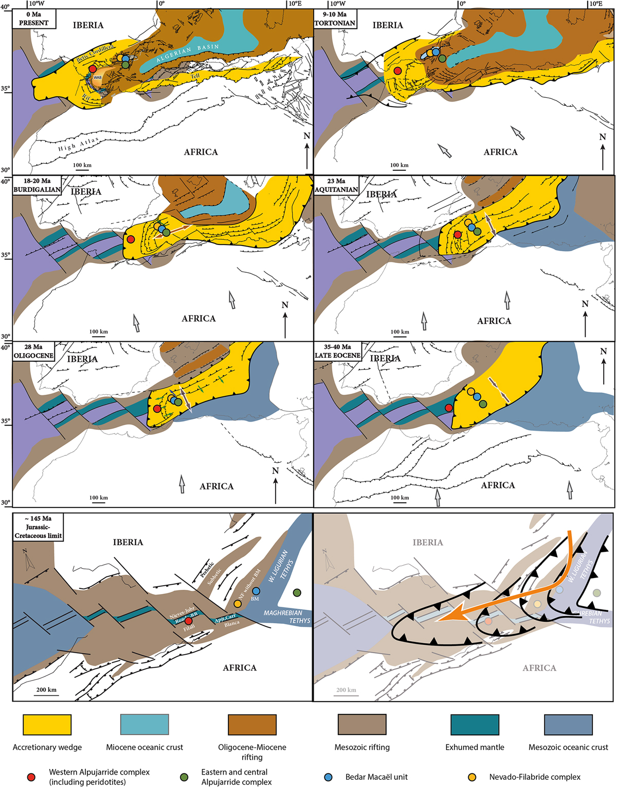
Fig. 17
Download original image
Reconstructions in map view of the evolution of the Western Mediterranean, modified after Leprêtre et al. (2018) and Romagny et al. (2020). The yellow domain represents the Alboran Domain progressively deforming and migrating through time. At the surface it is mainly the Malaguide Complex and at depth the Alpujárride-Sebtide Complex. It progressively incorporates units by tectonic accretion at the expense of the rifted domain or partly oceanized Betic Ocean. The lower right panel shows the basic principle of this complex 3-D evolution where a non-cylindrical rift partly evolved into oceanic domains is progressively incorporated into the accretionary wedge during slab retreat leading to the variations in P-T evolution from east to west in the Betic Cordillera. Before 20 Ma shortening is mostly N-S or NW-SE and the kinematics of exhumation is also along the same direction. After 20 Ma the main kinematics is E-W with a migration of the Alboran domain and retreat of the slab toward the west. Nieves-Jubr: Nieves Unit and Jubrique Unit, Ronda-BB: Ronda and Beni Bousera peridotites, Apjt, Carr: Sierra Alpujata and Sierra de Carratraca peridotites, NF without BM: Nevado-Filábride without Bédar-Macael unit, BM: Bédar-Macael Unit.
Current usage metrics show cumulative count of Article Views (full-text article views including HTML views, PDF and ePub downloads, according to the available data) and Abstracts Views on Vision4Press platform.
Data correspond to usage on the plateform after 2015. The current usage metrics is available 48-96 hours after online publication and is updated daily on week days.
Initial download of the metrics may take a while.