Fig. 3

Download original image
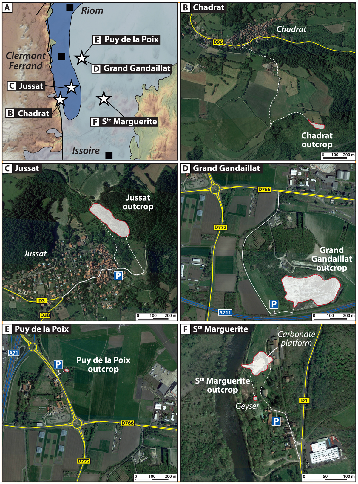
A. Map showing the paleogeographic extensions of the lake during the Oligocene and Miocene (adapted from Hugueney et al., 1999) of the Limagne Basin and localization of the visited sites during the m-fed fieldtrip (satellite images from © Microsoft Corporation – Imagery © Harris Corp, Earthstar Geographics LLC). B. Localization of the Chadrat outcrop. C. Jussat outcrop (ancient quarry). D. Grand Gandaillat quarry. E. Puy de la Poix outcrop. F. Saint Marguerite outcrop with the modern carbonate platform.
Current usage metrics show cumulative count of Article Views (full-text article views including HTML views, PDF and ePub downloads, according to the available data) and Abstracts Views on Vision4Press platform.
Data correspond to usage on the plateform after 2015. The current usage metrics is available 48-96 hours after online publication and is updated daily on week days.
Initial download of the metrics may take a while.


