")
")
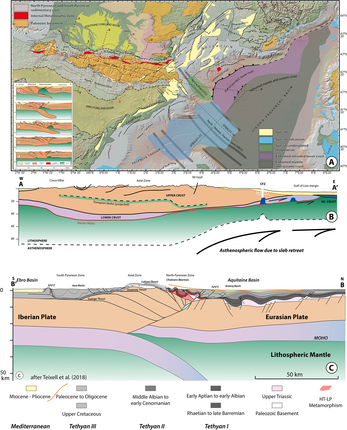
Fig. 11
Download original image
A. Tectonic map of the Pyrénées, Gulf of Lion and northeastern Valencia Basin. Aligned red triangles show the receiver-functions profiles of Chevrot et al. (2018) interpreted in the inset (from A to E, eastward). Dashed lines offshore show the position of the seismic lines of Figure 17. The dashed line along the strike of the Pyrénées reaching the Gulf of Lion margin is the section shown below. AMB: Arzacq-Mauléon Basin; BS: Boucheville Syncline; CV: Cinco Villas Massif; NMU: Nappe des Marbres Unit; GLP2: Golfe du Lion profond drillhole #2. B. Along-strike section of the Pyrénées and Gulf of Lion margin. CFZ: Catalan Fracture (Transfer) Zone. C. Across-strike section of the Central Pyrénées, modified after Teixell et al. (2018) showing the different stages discussed in the paper.
Current usage metrics show cumulative count of Article Views (full-text article views including HTML views, PDF and ePub downloads, according to the available data) and Abstracts Views on Vision4Press platform.
Data correspond to usage on the plateform after 2015. The current usage metrics is available 48-96 hours after online publication and is updated daily on week days.
Initial download of the metrics may take a while.