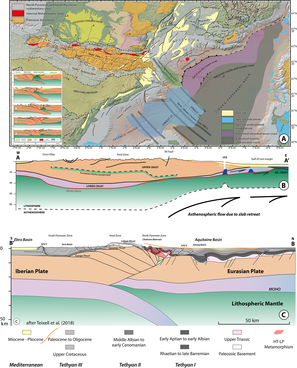
Fig. 11

Download original image
A. Tectonic map of the Pyrénées, Gulf of Lion and northeastern Valencia Basin. Aligned red triangles show the receiver-functions profiles of Chevrot et al. (2018) interpreted in the inset (from A to E, eastward). Dashed lines offshore show the position of the seismic lines of Figure 17. The dashed line along the strike of the Pyrénées reaching the Gulf of Lion margin is the section shown below. AMB: Arzacq-Mauléon Basin; BS: Boucheville Syncline; CV: Cinco Villas Massif; NMU: Nappe des Marbres Unit; GLP2: Golfe du Lion profond drillhole #2. B. Along-strike section of the Pyrénées and Gulf of Lion margin. CFZ: Catalan Fracture (Transfer) Zone. C. Across-strike section of the Central Pyrénées, modified after Teixell et al. (2018) showing the different stages discussed in the paper.
Les statistiques affichées correspondent au cumul d'une part des vues des résumés de l'article et d'autre part des vues et téléchargements de l'article plein-texte (PDF, Full-HTML, ePub... selon les formats disponibles) sur la platefome Vision4Press.
Les statistiques sont disponibles avec un délai de 48 à 96 heures et sont mises à jour quotidiennement en semaine.
Le chargement des statistiques peut être long.


