")
")
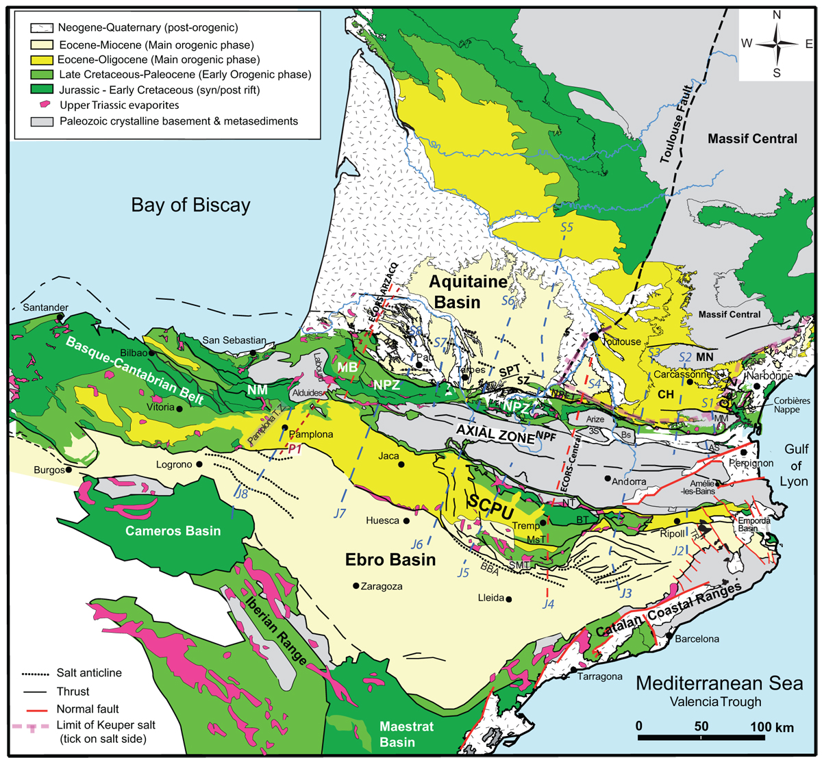
Fig. 3
Download original image
Simplified geological map of Pyrenees. Abbreviations in northern Pyrenees: NPFT: North Pyrenean Frontal Thrust; NPZ: North Pyrenean Zone; NPF: North Pyrenean Fault; SZ: Subpyrenean Zone; MB: Mauléon Basin; CH: Carcassonne High; CLTZ: Corbières-Languedoc Transfer Zone. North Pyrenean basement massifs: AS: Agly-Salvezines; MM: Mouthoumet; MN: Montagne Noire Massif; BS: Saint Barthelemy; 3S: Trois Seigneurs. Abbreviations in southern Pyrenees: South Central Pyrenean Units; NT: Nogueres Thrust; BT: Bóixols Thrust; MsT: Monsec Thrust; SMT: Serres Marginals Thrust; BBA: Barbastro-Balaguer Anticline; SA: Sanaüja Anticline; TR: Transverse Ranges. Blue dashed lines locate cross-sections in Figures 7 and 8 and some crustal scale cross-sections along the same lines in Figure 4. Red dashed lines ECORS deep seismic crustal cross-sections (Fig. 4) and the deep seismic tomography profile P1 (Chevrot et al., 2018) in the NW Pyrenees.
Current usage metrics show cumulative count of Article Views (full-text article views including HTML views, PDF and ePub downloads, according to the available data) and Abstracts Views on Vision4Press platform.
Data correspond to usage on the plateform after 2015. The current usage metrics is available 48-96 hours after online publication and is updated daily on week days.
Initial download of the metrics may take a while.