Fig. 1

Download original image
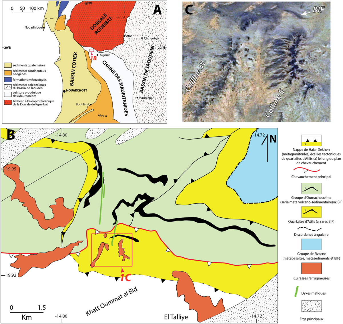
A : carte géologique simplifiée du Nord-Ouest de la Mauritanie (modifiée de Pitfield et al., 2004) ; B : carte structurale de la région de Khat Oummat Elbid (encart en A) depuis les cartes géologiques d’Akjoujt (Marcelin, 1968 : Pitfield et al., 2004) modifiées et réinterprétées par nos données ; C : image satellite Google Earth de la zone d’étude (encart en B) montrant les deux collines Ouest et Est coiffées de formations ferrugineuses (en sombre) sur un socle constitué des quartzites d’Atilis comportant quelques BIF au Nord.
A: simplified geological map of North-West Mauritania (modified from Pitfield et al., 2004); B: structural map of the Khat Oummat Elbid region (inset in A) from the Akjoujt geological maps (Marcelin, 1968; Pitfield et al., 2004) modified and reinterpreted by our data; C: Google Earth satellite image of the study area (inset in B) showing the two West and East hills topped with ferruginous formations (in dark) on a basement made up of Atilis quartzites including few BIFs to the North.
Current usage metrics show cumulative count of Article Views (full-text article views including HTML views, PDF and ePub downloads, according to the available data) and Abstracts Views on Vision4Press platform.
Data correspond to usage on the plateform after 2015. The current usage metrics is available 48-96 hours after online publication and is updated daily on week days.
Initial download of the metrics may take a while.


