")
")
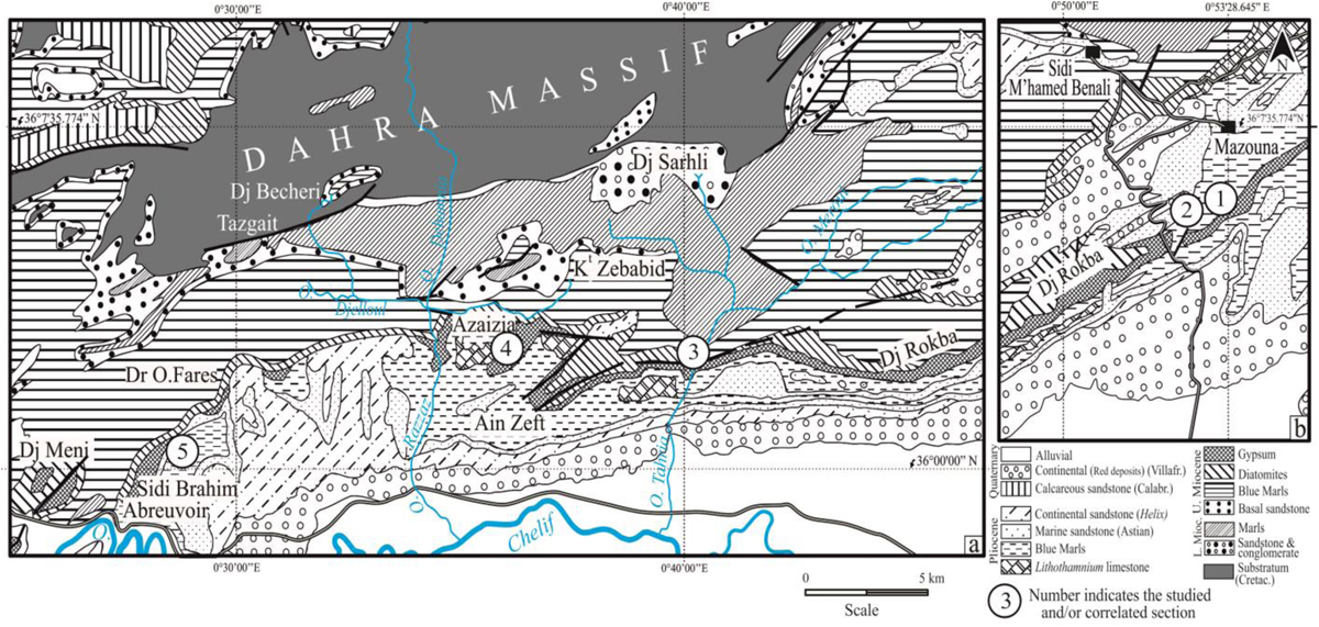
Fig. 2
Download original image
Geological maps of the Western (a) and Eastern (b) Dahra Massif (partly modified from Perrodon, 1957), showing the Late Miocene to Pliocene lithostratigraphic succession and the location of the studied and/or correlated sections. 1, Djebel El Abiod; 2, Hgaf Tamda; 3, Oued Tarhia; 4, Azaïzia; 5, Sidi Brahim Telegraph.
Carte géologique du massif du Dahra occidental (a) et oriental (b) d’après Perrodon (1957).
Current usage metrics show cumulative count of Article Views (full-text article views including HTML views, PDF and ePub downloads, according to the available data) and Abstracts Views on Vision4Press platform.
Data correspond to usage on the plateform after 2015. The current usage metrics is available 48-96 hours after online publication and is updated daily on week days.
Initial download of the metrics may take a while.