")
")
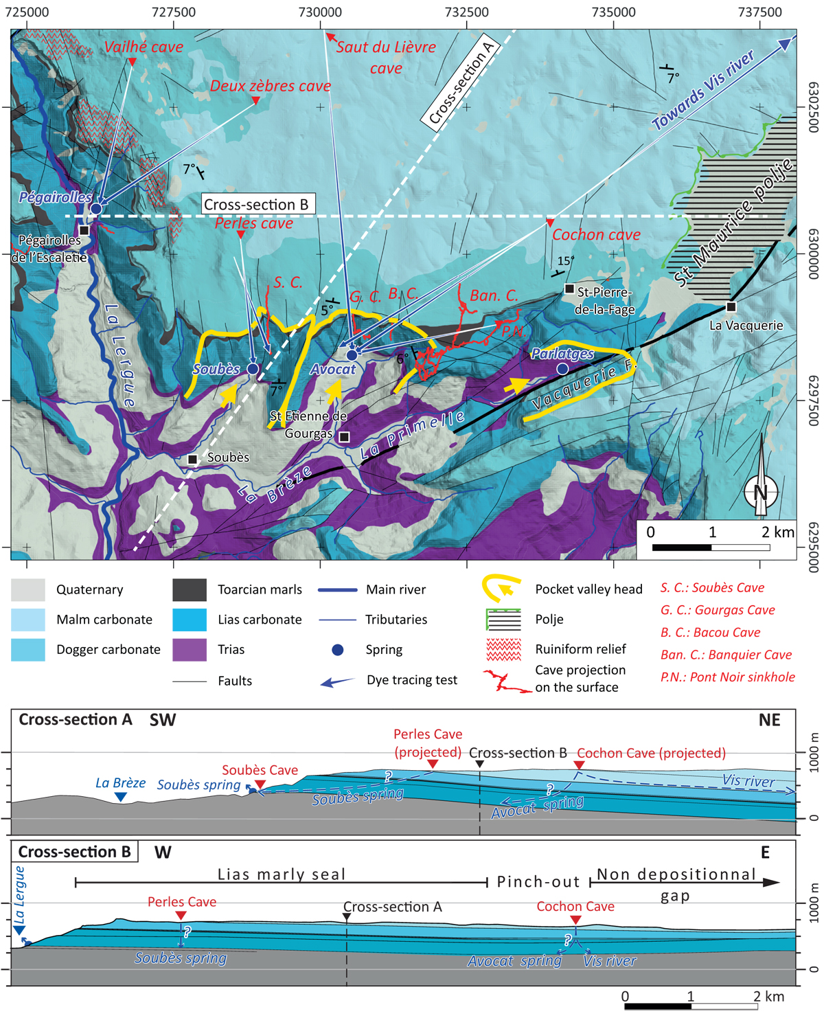
Fig. 5
Download original image
Simplified geological and geomorphological map of the study area (location in Figure 3), synthesised from BRGM 1/50000 map of Le Caylar (Alabouvette et al., 1988), with speleological networks projected vertically on the surface in red, compiled from the Larzac Explo Celadon database (Larzac Explo Celadon, 2023). The locations of cross-sections are indicated by white dotted lines on the map. Cross-section A reveals the plateau as a monoclinal ramp gently dipping to the North. Cross-section B highlights the pinch-out of the seal unit eastwards, resulting in a non-depositional gap near St-Pierre-de-la-Fage. Consequently, to the east, the aquifer is continuous, whereas to the west, the upper and lower aquifers are separated by a marly seal unit.
Current usage metrics show cumulative count of Article Views (full-text article views including HTML views, PDF and ePub downloads, according to the available data) and Abstracts Views on Vision4Press platform.
Data correspond to usage on the plateform after 2015. The current usage metrics is available 48-96 hours after online publication and is updated daily on week days.
Initial download of the metrics may take a while.