Fig. 1

Download original image
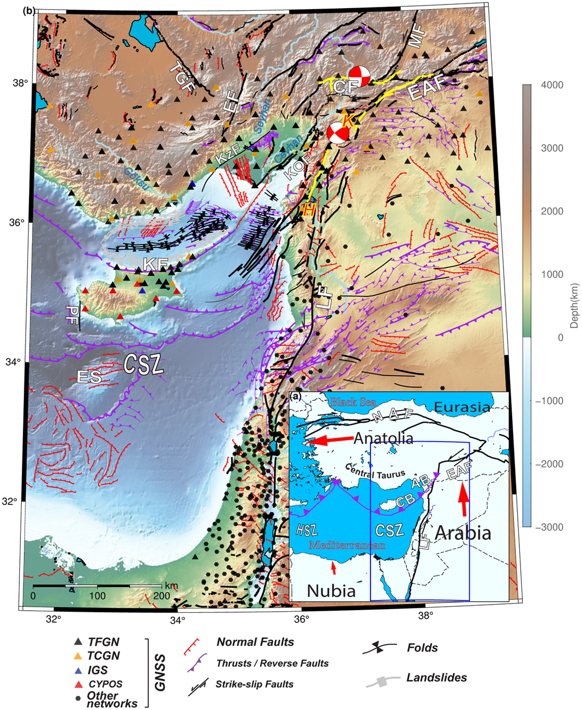
a) Tectonics of the Eastern Mediterranean and fundamental features in the scope of this study. Abbreviations: EAF: East Anatolian Fault, NAF: North Anatolian Fault, LF: Levant Fault, CSZ: Cyprus Subduction Zone, HSZ: Hellenic Subduction Zone, AB: Adana Basin, CB: Cilicia Basin b) Tectonic structures and GNSS sites around the region. Structures digitized from Emre et al. (2013, 2018); Şengör and Zabci (2019), the structures around Adana/Cilicia basins are taken from Aksu et al., 2005; Burton-Ferguson et al., 2005; Aksu et al., 2014a, 2021, and cited studies therein). The main boundaries are represented with thicker lines. Focal mechanisms belong to 06 Feb 2023 Mw=7.8 and Mw=7.6 Kahramanmaraş Pazarcik and Elbistan earthquakes. The surface rupture geometry, shown in yellow lines, is taken from the U.S. Geological Survey (USGS) with Data Release (doi: 10.5066/P985I7U2). Abbreviations: K=Kahramanmaraş triple junction, H=Hatay triple junction, KF: Kyrenia Fault, CF: Cardak Fault, MF: Malatya Fault, EF: Ecemiş Fault, KOF: Karatas-Osmaniye Fault, TGF: Tuz Gölü Fault, KZF: Kozan Fault, PF: Paphos Fault, ES: Eratosthenes seamount, IGS: International GNSS Service, TCGN: Turkey Continuous GNSS Network, TFGN: Turkey Fundamental GNSS Network, CYPOS: Cyprus Positioning System. We consistently employ the same abbreviations throughout all figures in this text, adhering to those presented in this figure, as necessary.
Current usage metrics show cumulative count of Article Views (full-text article views including HTML views, PDF and ePub downloads, according to the available data) and Abstracts Views on Vision4Press platform.
Data correspond to usage on the plateform after 2015. The current usage metrics is available 48-96 hours after online publication and is updated daily on week days.
Initial download of the metrics may take a while.


