")
")
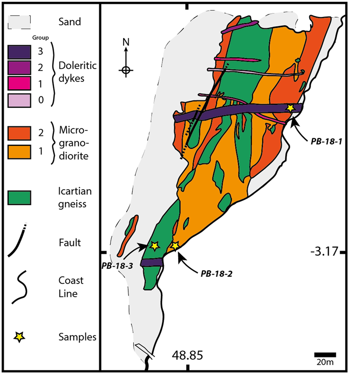
Fig. 4
Download original image
Simplified geological map of the Port-Béni coastal foreshore and sampling locations. Microgranodiorites 1 and 2: porphyritic Pleubian microgranodiorite, phenocryst-rich and phenocryst-poorer facies, respectively. Doleritic dykes: 1 to 3, compositional groups from Lees et al. (1991) and Roach et al. (1992); 0, undifferentiated from any of these groups; 1, spilites and “albitophyres d’Er” (Auvray et al., 1976; Auvray, 1979); 2 and 3, Trieux dolerites, Talbert and Launay dolerites (Lahaye et al., 1995), respectively. Numbers also underline relative chronologies. Note that only two structural groups of doleritic dykes can be identified on the map (see text).
Current usage metrics show cumulative count of Article Views (full-text article views including HTML views, PDF and ePub downloads, according to the available data) and Abstracts Views on Vision4Press platform.
Data correspond to usage on the plateform after 2015. The current usage metrics is available 48-96 hours after online publication and is updated daily on week days.
Initial download of the metrics may take a while.