")
")
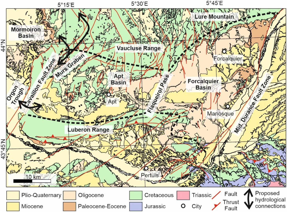
Fig. 2
Download original image
Regional geological map of the Manosque Basin and its two sub-basins (Apt and Forcalquier Basins), highlighting the localities and geological features discussed in the text (modified after SIT-PNR-PACA-Luberon, http://sit.pnrpaca.org/pnr_geologie/index.html).The extent of the Apt and Forcalquier sub-basins, separated by Flaqueirol Pass, is shown with thick dashed lines. Black arrows show the proposed hydrological connections between the Apt Basin and the ECRIS basins further west.
Current usage metrics show cumulative count of Article Views (full-text article views including HTML views, PDF and ePub downloads, according to the available data) and Abstracts Views on Vision4Press platform.
Data correspond to usage on the plateform after 2015. The current usage metrics is available 48-96 hours after online publication and is updated daily on week days.
Initial download of the metrics may take a while.