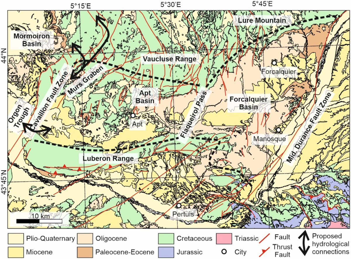
Fig. 2

Download original image
Regional geological map of the Manosque Basin and its two sub-basins (Apt and Forcalquier Basins), highlighting the localities and geological features discussed in the text (modified after SIT-PNR-PACA-Luberon, http://sit.pnrpaca.org/pnr_geologie/index.html).The extent of the Apt and Forcalquier sub-basins, separated by Flaqueirol Pass, is shown with thick dashed lines. Black arrows show the proposed hydrological connections between the Apt Basin and the ECRIS basins further west.
Les statistiques affichées correspondent au cumul d'une part des vues des résumés de l'article et d'autre part des vues et téléchargements de l'article plein-texte (PDF, Full-HTML, ePub... selon les formats disponibles) sur la platefome Vision4Press.
Les statistiques sont disponibles avec un délai de 48 à 96 heures et sont mises à jour quotidiennement en semaine.
Le chargement des statistiques peut être long.


