


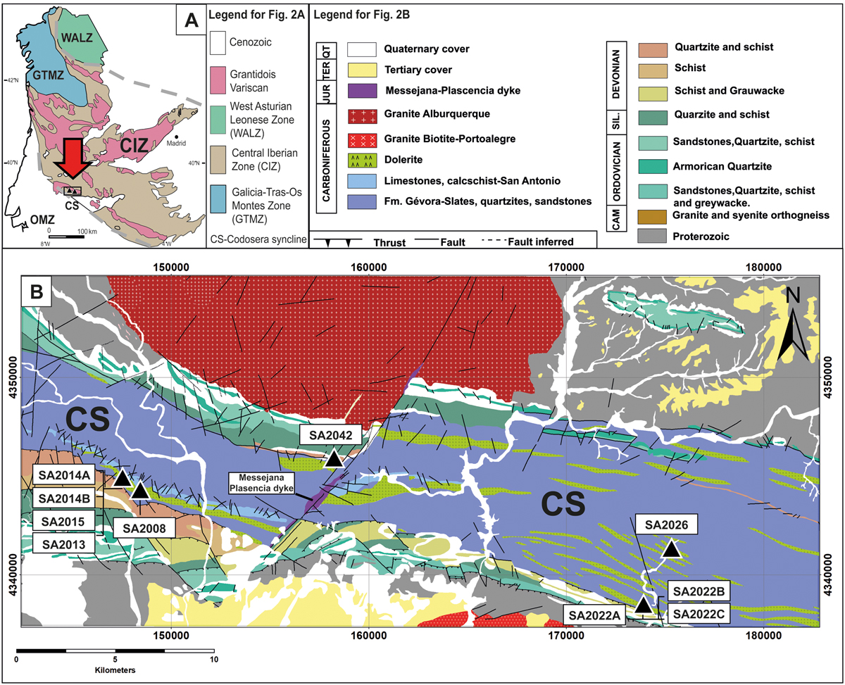
Fig. 2
Download original image
A) Simplified geological map of the Iberian Massif showing the studied area of La Codosera syncline (CS). Modified after López-Moro et al. (2020) and references therein ; B) Geological map of the CS showing the mafic samples studied in this work. This map was created based on the Geological Maps (scale 1:50000) of Alburquerque (Santos García and Casas Ruiz, 1982), Puebla de Obando (López Díaz et al., 1989), Villar del Rey (Santos García et al., 1990) and Botoa (Insua Marquez et al., 1990).
Current usage metrics show cumulative count of Article Views (full-text article views including HTML views, PDF and ePub downloads, according to the available data) and Abstracts Views on Vision4Press platform.
Data correspond to usage on the plateform after 2015. The current usage metrics is available 48-96 hours after online publication and is updated daily on week days.
Initial download of the metrics may take a while.