")
")
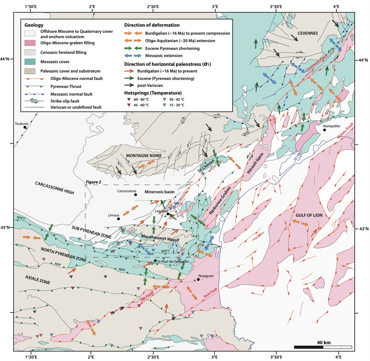
Fig. 1
Download original image
Regional tectonics map with directions of horizontal deformations and paleostresses at different stages. Post-Variscan strike-slip motion in dark grey after Arthaud and Matte (1975); Matte (1986); Van den Dreissche and Brun (1992). Mesozoic Tethysian then Albo-Cenomanian rifting in blue arrows modified after Lemoine et al. (1986); Séranne et al. (1995); (2002); Bonijoly et al. (1996); Clerc and Lagabrielle (2014); Clerc et al. (2016); Ford and Vergès (2020); Crémadès et al. (2021). Pyrenean shortening directions in green after Arthaud and Séguret (1981); Arthaud and Laurent (1995); Séranne et al. (1995); Mascle et al. (1996); Lacombe and Jolivet (2005); Parizot et al. (2021; 2022). Oligo-Miocene extension, recent stress and deformation directions in orange arrows after Gorini et al. (1991, 1994); Séranne et al. (1995; 2002; 2021); Mascle et al. (1996); Goula et al. (1999); Séranne (1999); Mauffret et al. (2001); Rigo et al. (2015); Mazzotti et al. (2021); (Milési et al. 2020; 2022) and Parizot et al. (2021, 2022). Black dashed rectangle indicates the location of Figures 2 and 8. Geological data are extracted from the 1M-scale French Geological map (6th edition). The Gulf of Lion geometry is based on Séranne et al. (1995); Mauffret et al. (2001) and Jolivet et al. (2020). NPFT: Northern Pyrenean Frontal Thrust, NPF: Northern Pyrenean Fault. Hotsprings of the Pyrénées are extracted from BRGM maps and memoirs (see text for references) and Taillefer et al. (2018).
Current usage metrics show cumulative count of Article Views (full-text article views including HTML views, PDF and ePub downloads, according to the available data) and Abstracts Views on Vision4Press platform.
Data correspond to usage on the plateform after 2015. The current usage metrics is available 48-96 hours after online publication and is updated daily on week days.
Initial download of the metrics may take a while.