")
")
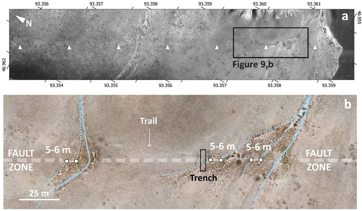
Fig. 10
Download original image
a: Pleiades image showing the fault trace of the HUNF within the northwestern-most part of our study area; white triangles point out the fault trace. The black frame corresponds to Figure 10b. b: Orthophotograph taken from a drone survey detailing the fault trace within offset young cones debris. The white dashed transparent line defines the fault zone (about 20 m width). Blue lines represents active drainage and abandoned drainages (dashed), the latter are offset and used with the points as piercing lines and points respectively. Note the moto-trail track more or less parallel to the fault trace perturbing the morphotectonic analysis. The black rectangle corresponds to the trench called Stubborn Beetle (SB).
Current usage metrics show cumulative count of Article Views (full-text article views including HTML views, PDF and ePub downloads, according to the available data) and Abstracts Views on Vision4Press platform.
Data correspond to usage on the plateform after 2015. The current usage metrics is available 48-96 hours after online publication and is updated daily on week days.
Initial download of the metrics may take a while.