")
")
Fig. 4
Download original image
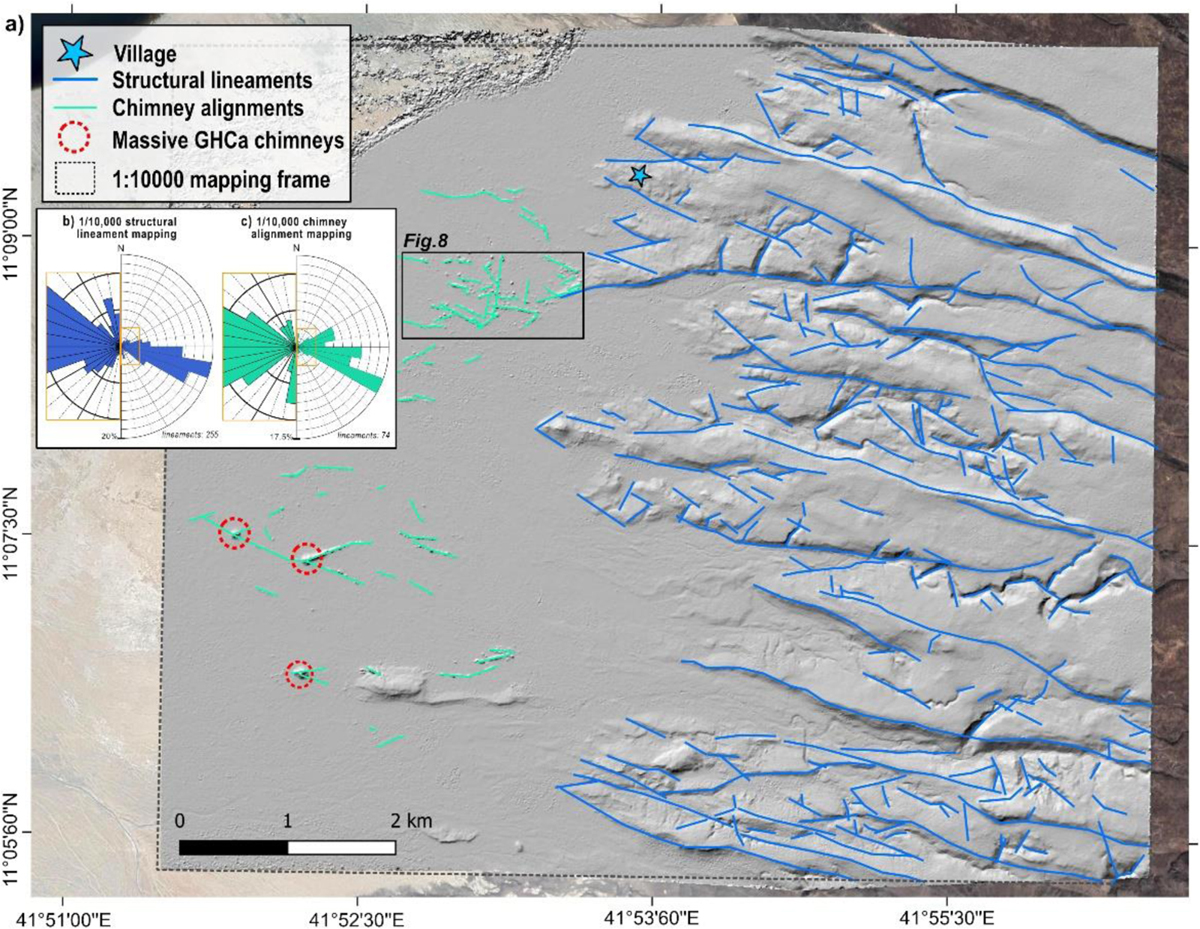
a) Lineament mapping of the LAGF area on a Pléiades dataset-based DEM hillshade image. Structural lineaments within the Stratoid Series hills are shown as blue lines. Hydrothermal chimney alignments observed over the basin sedimentary flats are shown as green lines. b) 1/10,000 scale structural lineament mapping and c) 1/10,000 scale hydrothermal chimney alignment mapping. For each sub-figure, the whole dataset is presented on the half rose diagram on the right, and a zoom of its central part (orange rectangle) is shown on the left to highlight minor sets.
Current usage metrics show cumulative count of Article Views (full-text article views including HTML views, PDF and ePub downloads, according to the available data) and Abstracts Views on Vision4Press platform.
Data correspond to usage on the plateform after 2015. The current usage metrics is available 48-96 hours after online publication and is updated daily on week days.
Initial download of the metrics may take a while.