")
")
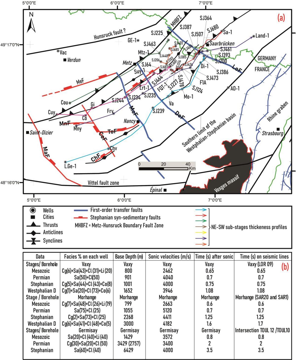
Fig. 4
Download original image
(a): Wells location on the structural map. Note also the location of the different NE-SW sub-stages thickness profiles from well data. These thickness profiles are presented on Figure. The map is projected with Lambert 93 system explaining the gap of the X and Y coordinates locations. (b): Summary of the different parameters used in the seismic-to-well tie procedure. Cg (conglomerate), Cl (claystone), Co (coal), Li (limestone) and Sa (sandstone).
Current usage metrics show cumulative count of Article Views (full-text article views including HTML views, PDF and ePub downloads, according to the available data) and Abstracts Views on Vision4Press platform.
Data correspond to usage on the plateform after 2015. The current usage metrics is available 48-96 hours after online publication and is updated daily on week days.
Initial download of the metrics may take a while.