")
")
Fig. 9
Download original image
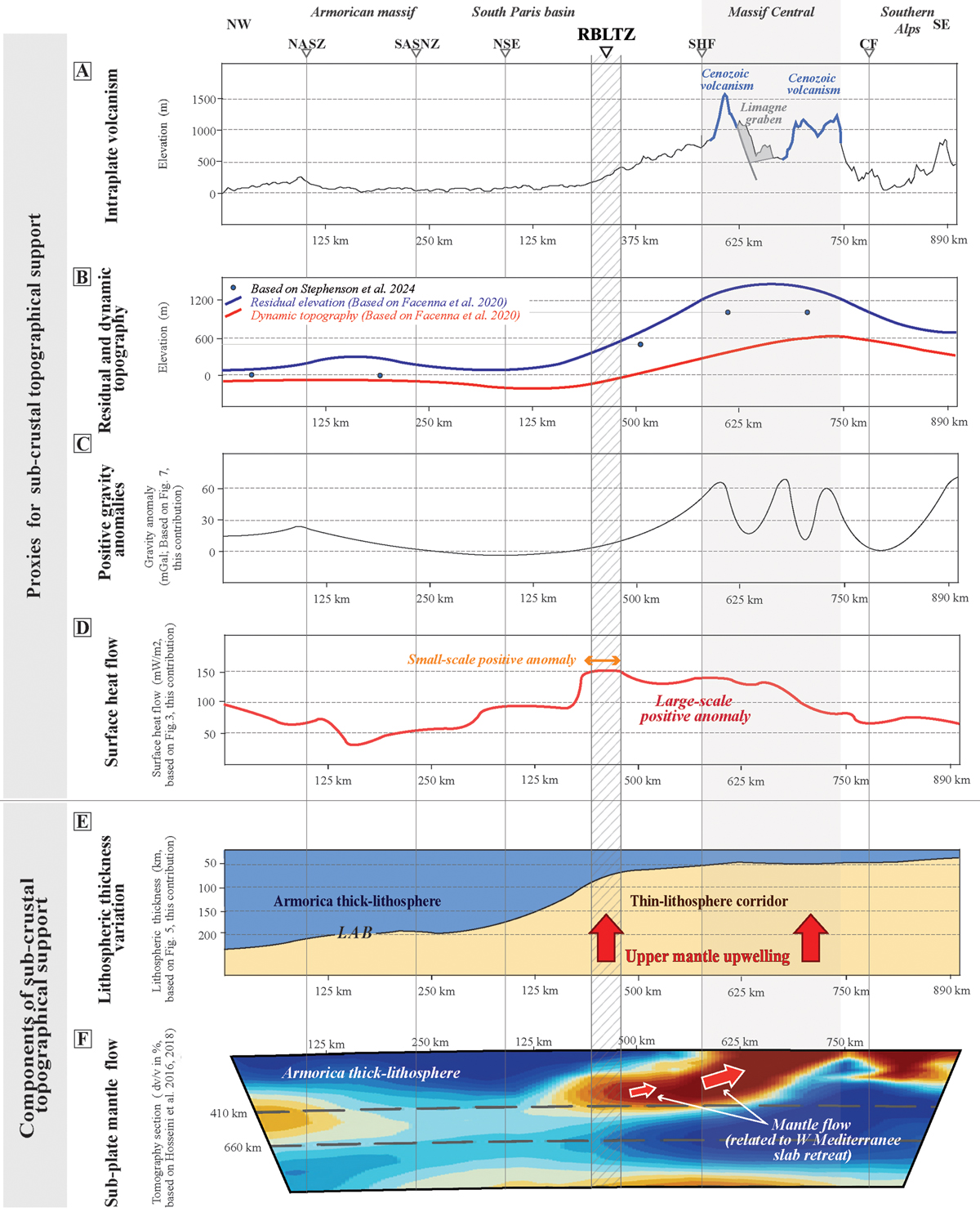
Components of sub-crustal topographical support and surface heat flow on a Brittany-Southern Subalpine Chaîne section (location in Figs. 1, 3, 4AB, 6, 7 and 11A). A) topographic data from source etopo 1: http://www.ndgc.noaa.gov/mgg/fl (from Faccenna and Becker (2020), and Stephenson et al. (2024) and B) dynamic topography (From Faccenna and Becker, 2020), C) Gravity anomaly data from Sandwell et al. (2014), D) surface heat flow data (modified from Lucazeau and Vasseur (1989) and interpolated from The Global Heat Flow Database: Update 2023). Note the superposition of the Rhine-Bresse-Limagne transfer zone (RBLTZ) and the small-scale heat flow anomaly suggesting that RBLTZ is a lithospheric fault zone connecting surface and mantle, E) lithopheric thickness modified from (Pasyanos et al., 2014). The RBLTZ-Massif Central domain is limited to west by the thick-lithosphere of Armorican and it corresponds to a corridor of thin lithosphere associated with upper mantle upwelling and probably edge driven convection, F) P-wave seismic tomography section. The depths of the dashed lines are 410 and 660 km from the surface.
Current usage metrics show cumulative count of Article Views (full-text article views including HTML views, PDF and ePub downloads, according to the available data) and Abstracts Views on Vision4Press platform.
Data correspond to usage on the plateform after 2015. The current usage metrics is available 48-96 hours after online publication and is updated daily on week days.
Initial download of the metrics may take a while.