")
")
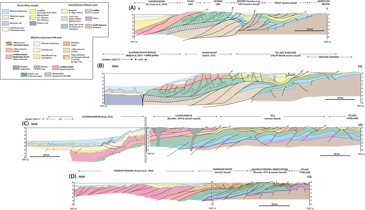
Fig. 3
Download original image
Cross-sections of the Tell-Rif system. Sections were built using surface geology, wells and property reflection seismic data. From west to east: (a) eastern Rif belt section cutting through the Flyschs unit, the Ketama unit, intrachain Neogene basins (Taounate) and associated Jurassic units, and Tsoul nappe on top of the Late Miocene foredeep. Main map reference is Suter (1980a, 1980b) completed by our team fieldwork; (b) Western Algerian Tell section, from the offshore, the Dahra Massif, Miocene Chelif Basin, and Tellian nappes resting on the early Miocene foredeep. Major map references are within the works by Delteil (1974), Fenet (1975), Polvêche (1960) and Thomas, (1985); (c) Eastern Algerian Tell section, from the offshore through the Lesser Kabylie, Flyschs unit, the Tellian nappes, and the Atlas domain. Main map references are within the work by Bouillin (1979) and Vila (1978, 1980); (d) Tunisian Tell section, from the offshore through the Numidian nappe, the imbricated frontal units, the Medjerda salt area, the Atlas domain. Principal map reference is the map by Rouvier (1977) for the Tunisian Tell.
Current usage metrics show cumulative count of Article Views (full-text article views including HTML views, PDF and ePub downloads, according to the available data) and Abstracts Views on Vision4Press platform.
Data correspond to usage on the plateform after 2015. The current usage metrics is available 48-96 hours after online publication and is updated daily on week days.
Initial download of the metrics may take a while.