")
")
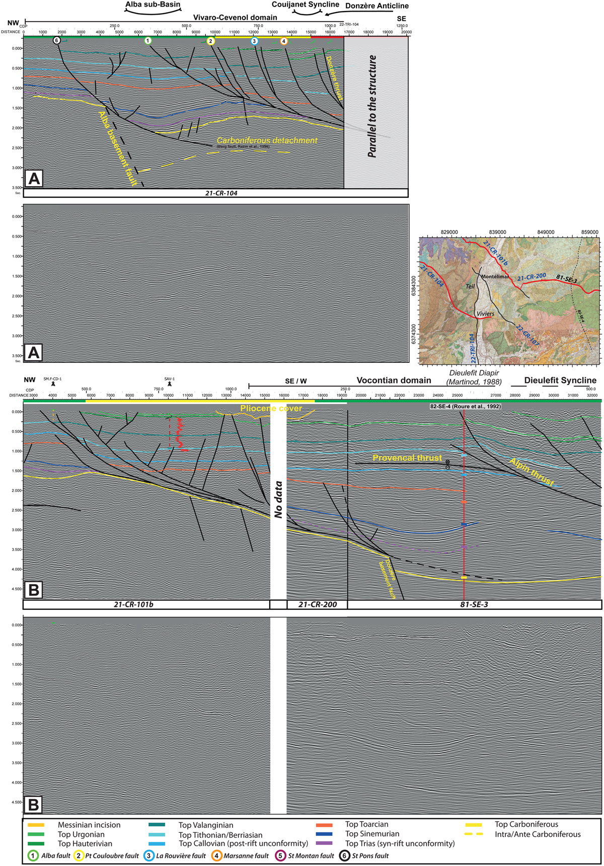
Fig. 7
Download original image
(A) and (B) correspond to seismic lines interpreted and uninterpreted with horizons layers and faults along sections 21-CR-104, and 21-CR-101b - 81-SE-3 transect, respectively. Locations of the seismic lines on the geological map (Supp. Mat. 3). Vertical scale is expressed in second two-way travel (TWT) and horizontal scale is in meter (m), The horizontal/vertical scale has been respected. See cross section on Supplementary material 3.
(A) et (B) correspondent aux lignes sismiques interprétées et non-interprétées avec des couches d’horizons et des failles le long des sections 21-CR-104, et 21-CR-101b - 81-SE-3 transect, respectivement. Localisation des lignes sismiques sur la carte géologique. L’échelle verticale est exprimée en secondes temps double (TWT) et l’échelle horizontale est exprimée en mètres (m). L’échelle horizontale/verticale a été respectée.
Current usage metrics show cumulative count of Article Views (full-text article views including HTML views, PDF and ePub downloads, according to the available data) and Abstracts Views on Vision4Press platform.
Data correspond to usage on the plateform after 2015. The current usage metrics is available 48-96 hours after online publication and is updated daily on week days.
Initial download of the metrics may take a while.