Fig. 8

Download original image
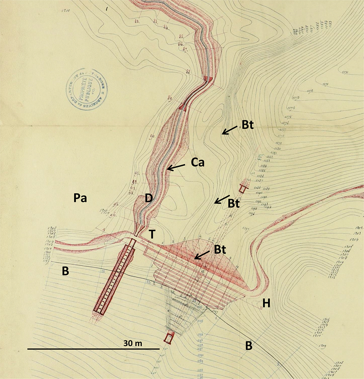
Extrait du plan topographique de l’entrée du lac en 1867 (AD63, S 0104 h). Relevé en courbes de niveau et projets d’aménagement (en rouge). B : bord du lac ; T : sommet du talus occidental ; D : dépression entre le talus et la pente de l’échancrure d’entrée du lac ; Bt : ligne de niveau de la base du talus occidental ; Ca : canal d’amenée d’eau depuis la Couze Chambourguet ; Pa : pente interne de l’échancrure d’accès au lac ; H : emplacement de l’hôtel-restaurant actuel. Les points D et T correspondent à peu près aux mêmes points sur la figure 6.
Plan of the access zone of the lake in 1867 (extract). Contour lines and laying out project (in red). B: lake shore; T: summit of the western enbankment; D: depression between the embankment and Pa, the side slope of the entrance of the lake; Bt: contour line of the base of the western enbankment; Ca: end of the diversion channel of Couze Chambourguet river; Pa: side slope of the entrance of the lake; H: situation of the Hotel-restaurant in 2019. Points D and T, are approximately the same as on Figure 6.
Current usage metrics show cumulative count of Article Views (full-text article views including HTML views, PDF and ePub downloads, according to the available data) and Abstracts Views on Vision4Press platform.
Data correspond to usage on the plateform after 2015. The current usage metrics is available 48-96 hours after online publication and is updated daily on week days.
Initial download of the metrics may take a while.


