")
")
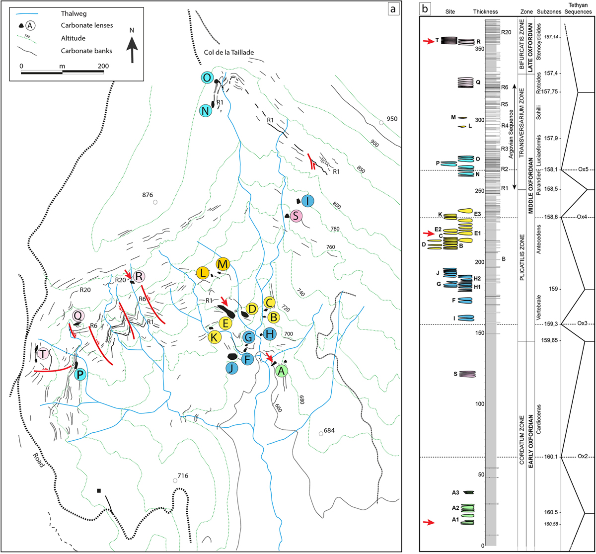
Fig. 2
Download original image
Left: detailed topographic map of the Beauvoisin area (modified after Gaillard et al., 1985). Nineteen sub-sites have been reported, including two new sites, S and T, which were exposed due to weathering since their initial discovery (Gay et al., 2019). Right: 360 m thick composite log of the Oxfordian in the Beauvoisin area (Gay et al., 2019). The red arrows show the three studied sub-sites A1, E1 and R, that developed during Early, Middle and Late Oxfordian respectively.
Current usage metrics show cumulative count of Article Views (full-text article views including HTML views, PDF and ePub downloads, according to the available data) and Abstracts Views on Vision4Press platform.
Data correspond to usage on the plateform after 2015. The current usage metrics is available 48-96 hours after online publication and is updated daily on week days.
Initial download of the metrics may take a while.