")
")
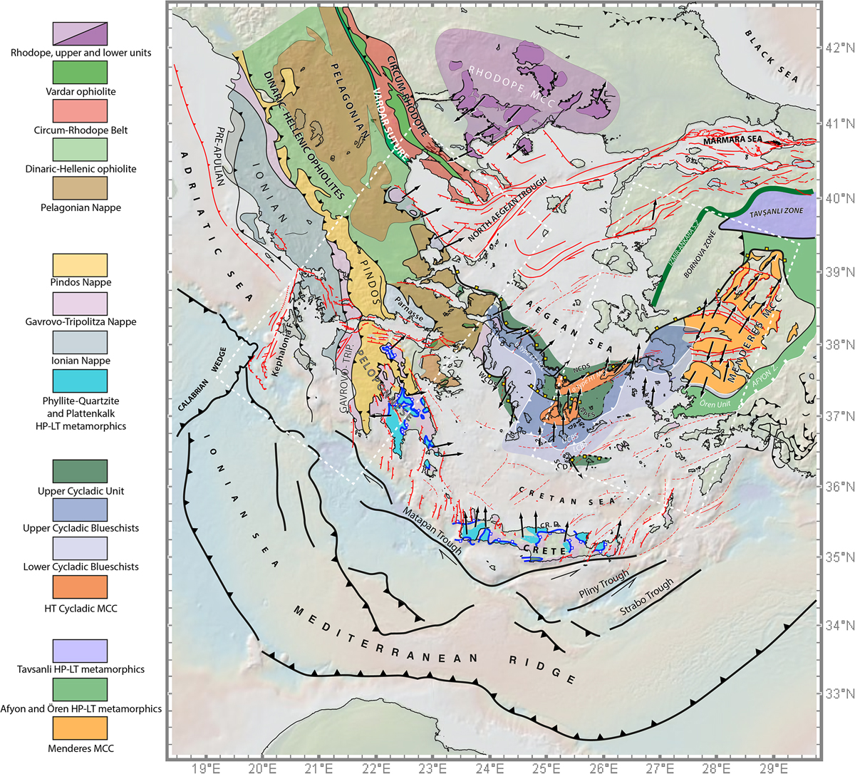
Fig. 9
Download original image
Tectonic map of the Aegean region (Gessner et al., 2001; Le Pichon et al., 2002; Chamot-Rooke et al., 2005; Brun and Sokoutis, 2007, Brun and Sokoutis, 2018; Jolivet and Brun, 2010; Iglseder et al., 2011; Burg, 2012; Grasemann et al., 2012; van Hinsbergen and Schmid, 2012; Rabillard et al., 2015; Grasemann et al., 2017; Pérouse et al., 2017; Schneider et al., 2018; Roche et al., 2019). White dotted frames represent the Central Hellenic Shear Zone (CHSZ) and the West Anatolian Shear Zone (WASZ). Red lines represent faults related to the recent strike-slip and extensional tectonics associated with the propagation of the North Anatolian Fault.
Current usage metrics show cumulative count of Article Views (full-text article views including HTML views, PDF and ePub downloads, according to the available data) and Abstracts Views on Vision4Press platform.
Data correspond to usage on the plateform after 2015. The current usage metrics is available 48-96 hours after online publication and is updated daily on week days.
Initial download of the metrics may take a while.