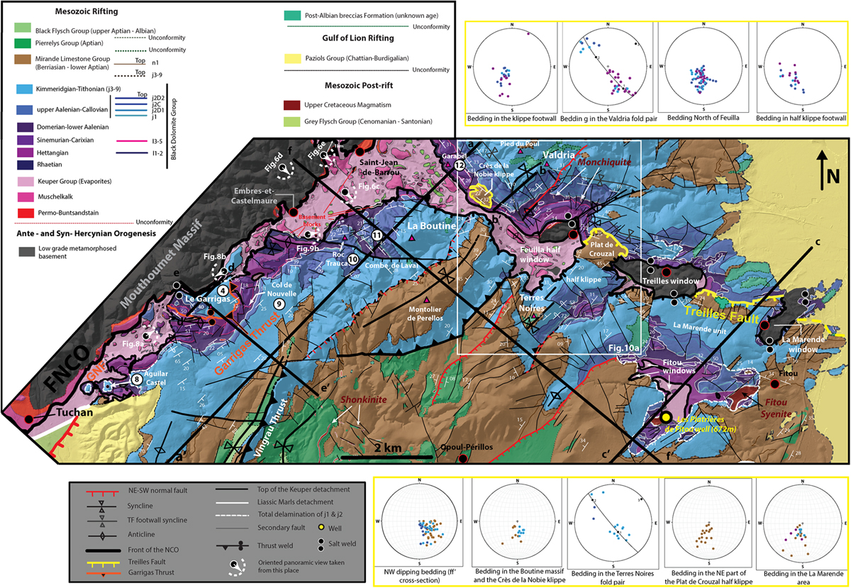
Fig. 5

Download original image
Reinterpreted geological map of the NCO in the SE border of the Mouthoumet massif and the Treilles Fault area based on BRGM maps. Black line represents the traces of cross-sections aa’, bb’, cc’, dd’, ee’ and ff’. The locations of the panoramas of Figures 6c, d, e, 8a, b and 9b are indicated. Dip data mesured on the field have been placed on the map. Poles to bedding (Jurassic to Neocomian) are plotted on Schmid lower hemisphere stereographic projections by sector of the Treilles Fault hanging wall (below map) and footwall (above map).
Current usage metrics show cumulative count of Article Views (full-text article views including HTML views, PDF and ePub downloads, according to the available data) and Abstracts Views on Vision4Press platform.
Data correspond to usage on the plateform after 2015. The current usage metrics is available 48-96 hours after online publication and is updated daily on week days.
Initial download of the metrics may take a while.


