")
")
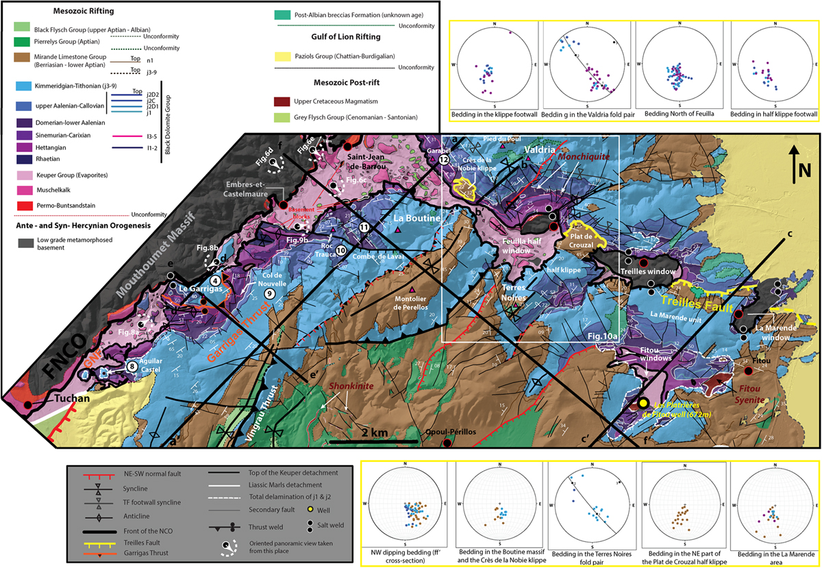
Fig. 5
Download original image
Reinterpreted geological map of the NCO in the SE border of the Mouthoumet massif and the Treilles Fault area based on BRGM maps. Black line represents the traces of cross-sections aa’, bb’, cc’, dd’, ee’ and ff’. The locations of the panoramas of Figures 6c, d, e, 8a, b and 9b are indicated. Dip data mesured on the field have been placed on the map. Poles to bedding (Jurassic to Neocomian) are plotted on Schmid lower hemisphere stereographic projections by sector of the Treilles Fault hanging wall (below map) and footwall (above map).
Les statistiques affichées correspondent au cumul d'une part des vues des résumés de l'article et d'autre part des vues et téléchargements de l'article plein-texte (PDF, Full-HTML, ePub... selon les formats disponibles) sur la platefome Vision4Press.
Les statistiques sont disponibles avec un délai de 48 à 96 heures et sont mises à jour quotidiennement en semaine.
Le chargement des statistiques peut être long.