")
")
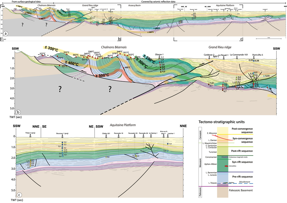
Fig. 9
Download original image
N-S geological cross-section across the Western Pyrénées (see location on Fig. 1) associated with measured Tmax and Vitrinite Reflectance data. The southern part of the section drawn from surface geology is modified from Labaume and Teixell (2020). According to the seismic reflection data, the vertical scale of the whole section is in two-way traveltime (second). To preserved coherency within the whole section, the southern part of the section constructed with surface geology was drawn in the prolongation of the seismic data based on TWT vertical-scale. (a) 100 km-long N-S stiking geological cross-section through the Chaînons Béarnais, Grand Rieu ridge, Arzacq Basin and the Aquitaine platform, built form a 2D reflection seismic composite line available in Figure S1. (b) close-up focused on the Chaînons Béarnais and the Grand Rieu ridge. (c) close-up focused on the Aquitaine platform.
Current usage metrics show cumulative count of Article Views (full-text article views including HTML views, PDF and ePub downloads, according to the available data) and Abstracts Views on Vision4Press platform.
Data correspond to usage on the plateform after 2015. The current usage metrics is available 48-96 hours after online publication and is updated daily on week days.
Initial download of the metrics may take a while.