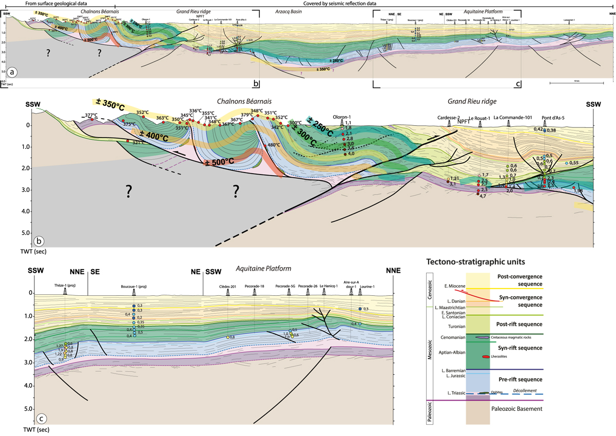
Fig. 9

Download original image
N-S geological cross-section across the Western Pyrénées (see location on Fig. 1) associated with measured Tmax and Vitrinite Reflectance data. The southern part of the section drawn from surface geology is modified from Labaume and Teixell (2020). According to the seismic reflection data, the vertical scale of the whole section is in two-way traveltime (second). To preserved coherency within the whole section, the southern part of the section constructed with surface geology was drawn in the prolongation of the seismic data based on TWT vertical-scale. (a) 100 km-long N-S stiking geological cross-section through the Chaînons Béarnais, Grand Rieu ridge, Arzacq Basin and the Aquitaine platform, built form a 2D reflection seismic composite line available in Figure S1. (b) close-up focused on the Chaînons Béarnais and the Grand Rieu ridge. (c) close-up focused on the Aquitaine platform.
Les statistiques affichées correspondent au cumul d'une part des vues des résumés de l'article et d'autre part des vues et téléchargements de l'article plein-texte (PDF, Full-HTML, ePub... selon les formats disponibles) sur la platefome Vision4Press.
Les statistiques sont disponibles avec un délai de 48 à 96 heures et sont mises à jour quotidiennement en semaine.
Le chargement des statistiques peut être long.


