")
")
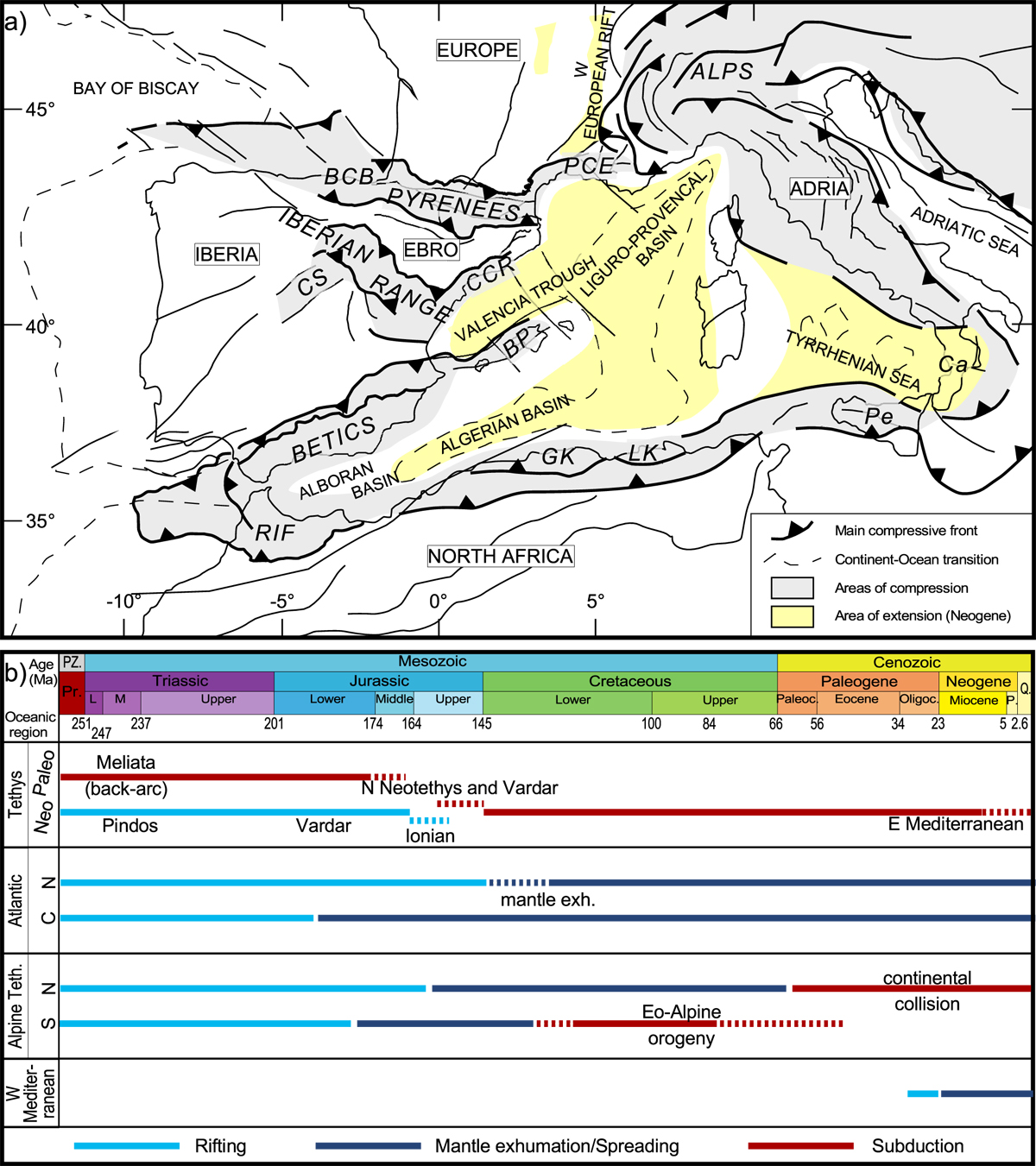
Fig. 1
Download original image
(a) Structural map of the West Mediterranean showing the main tectonic plates and deformed areas. Grey: areas deformed during Alpine compression. Yellow: area deformed during Neogene extension (West European Rift and opening of the Liguro-Provençal oceanic basin). BCB: Basque-Cantabrian Basin; BP: Balearic Promontory; Ca: Calabria; CCR: Catalan Coastal Range; CS: Central System; GK: Greater Kabylies; LK: Lesser Kabylies; PCE: Provence; Pe: Peloritan. (b) Geodynamic chart of oceanic domains in the West Mediterranean (W Tethys and N Atlantic) domain since the Permian. Light blue: rifting; dark blue: mantle exhumation/spreading; red: subduction.
Current usage metrics show cumulative count of Article Views (full-text article views including HTML views, PDF and ePub downloads, according to the available data) and Abstracts Views on Vision4Press platform.
Data correspond to usage on the plateform after 2015. The current usage metrics is available 48-96 hours after online publication and is updated daily on week days.
Initial download of the metrics may take a while.