")
")
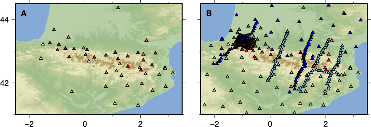
Fig. 3
Download original image
Map of seismic stations before (A) and after (B) the TOPO-IBERIA IberArray, PYROPE, and OROGEN projects. Before 2010, only permanent stations form the Réseau de Surveillance Sismique des Pyrénées (RSSP) (red triangles) and from the Réseau Large Bande Permanent (RLBP) (pink triangles) in France, and from the Institut Cartogràfic i Geològic de Catalunya (ICGC) (orange triangles) and Instituto Geogràfico Nacional (IGN) (light green triangles) in Spain operated in the Pyrénées. The station coverage was considerably improved over the last decade with the PYROPE (blue triangles), TOPO-IBERIA IberArray (green triangles), OROGEN (light blue triangles), and MAUPASACQ (brown triangles) temporary experiments.
Current usage metrics show cumulative count of Article Views (full-text article views including HTML views, PDF and ePub downloads, according to the available data) and Abstracts Views on Vision4Press platform.
Data correspond to usage on the plateform after 2015. The current usage metrics is available 48-96 hours after online publication and is updated daily on week days.
Initial download of the metrics may take a while.