")
")
Fig. 10
Download original image
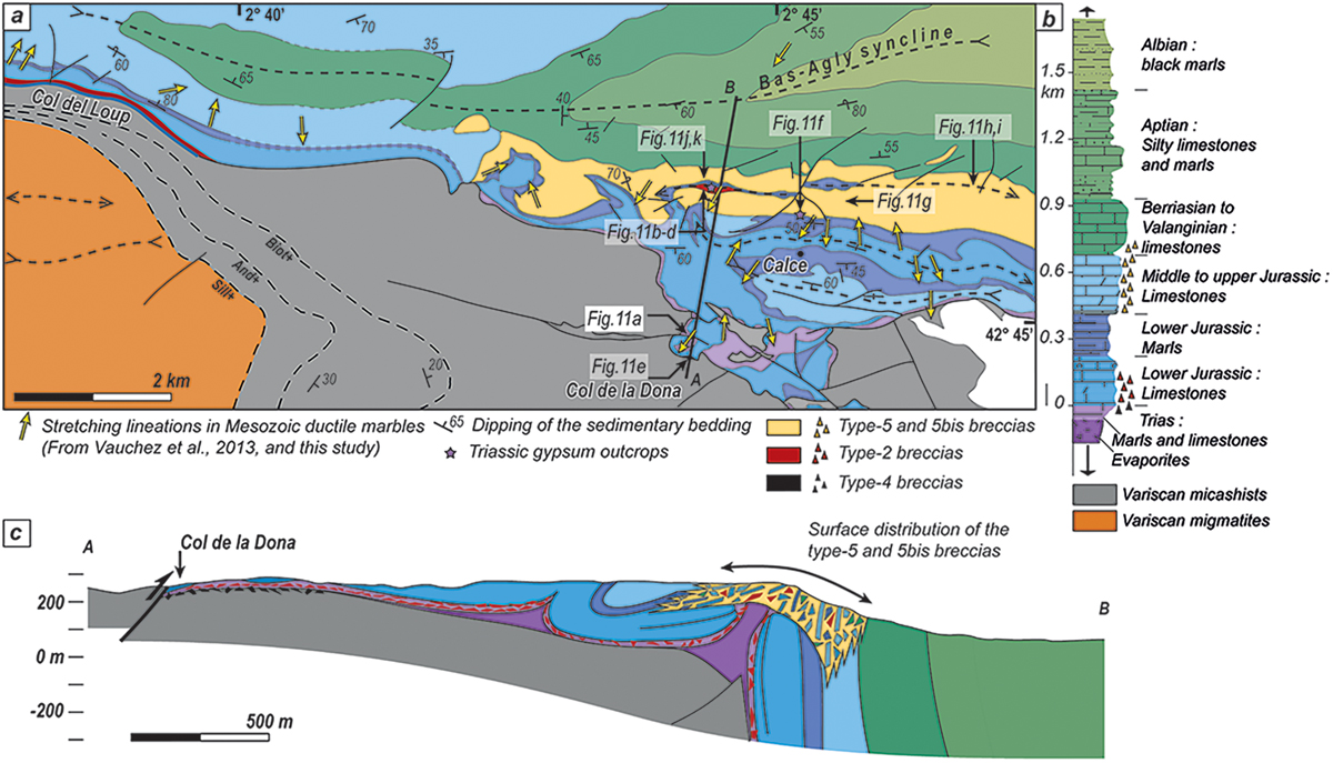
A) Detailed geological map of the southern part of the Bas-Agly syncline (Location in Fig. 1b). B) Lithostratigraphic log of the Mesozoic cover showing the structural position of the different types of breccias. C) N-S cross-section of the southern Bas-Agly.
A) Carte structurale détaillée du synclinal du Bas-Agly. B) Log lithostratigraphique de la couverture Mésozoïque du Bas-Agly. C) Coupe orientée NS de la partie sud du Bas-Agly.
Current usage metrics show cumulative count of Article Views (full-text article views including HTML views, PDF and ePub downloads, according to the available data) and Abstracts Views on Vision4Press platform.
Data correspond to usage on the plateform after 2015. The current usage metrics is available 48-96 hours after online publication and is updated daily on week days.
Initial download of the metrics may take a while.