Fig. 2

Download original image
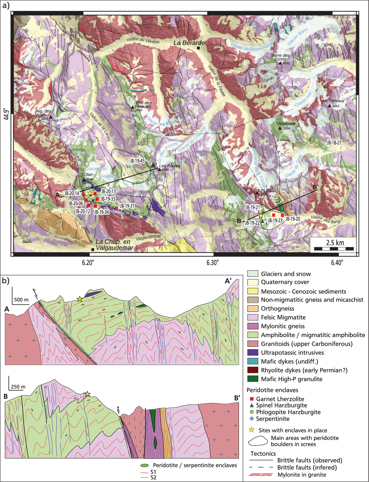
(a) Geological map of Central Pelvoux, modified from the BRGM 1:50 000 map of Saint-Christophe en Oisans (Barféty and Pêcher, 1984) with the position and nature of collected samples. Two sites were peridotites have been observed in place are shown with yellow stars. Areas were peridotite enclaves are relatively abundant in screes are highlighted by black dotted lines. (b) Interpretative cross-sections in the Olan-Rouies and Bans areas showing the general structuration of the massif, after Jacob et al. (2022) and Fréville et al. (2022). Ultramafic enclaves are found both in the flat-lying S1 and in the subvertical S2.
(a) Carte géologique de la partie centrale du massif du Pelvoux, modifiée à partir de la feuille BRGM 1:50 000 de Saint-Christophe en Oisans (Barféty et Pêcher, 1984), avec la position et la nature des échantillons collectés. Deux sites où des péridotites peuvent être observées en place sont indiqués par des étoiles jaunes. Les zones où les enclaves de péridotites sont relativement abondantes dans les éboulis sont mises en évidence par des lignes pointillées noires. (b) Coupes géologiques interprétatives montrant la structure générale du massif, d’après Jacob et al. (2022) et Fréville et al. (2022). Les enclaves ultramafiques se trouvent à la fois dans les foliations S1 et S2.
Current usage metrics show cumulative count of Article Views (full-text article views including HTML views, PDF and ePub downloads, according to the available data) and Abstracts Views on Vision4Press platform.
Data correspond to usage on the plateform after 2015. The current usage metrics is available 48-96 hours after online publication and is updated daily on week days.
Initial download of the metrics may take a while.


