")
")
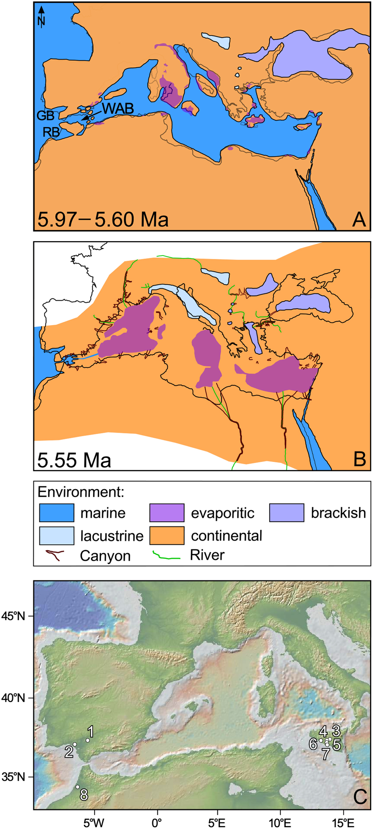
Fig. 1
Download original image
The Mediterranean region. A–B: Paleogeographic reconstruction of the Northeastern Atlantic and Mediterranean regions up to the Central Paratethys during the two steps of the Messinian Crisis: A, first (peripheral and limited) step; B, second (central and paroxysmal) step (Clauzon et al., 1996). These maps (modified from Suc et al., 2019) consider the occurrence of the volcanic arc proposed by Booth-Rea et al. (2018) and the resulting perched marine isolated basin in the Western Alboran Sea connected to the Atlantic Ocean by the pre-existing Gibraltar Strait (Krijgsman et al., 2018). GB, Guadalquivir Basin; RB, Rabat Basin; WAB, Western Alboran Basin. C: Location of the pollen localities considered in this paper. 1, Carmona; 2, Montemayor-1; 3, Capodarso; 4, Racalmuto; 5, Realmonte; 6, Eraclea Minoa; 7, Capo Rossello; 8, Bou Regreg. The map is elaborated using GeoMapApp (Ryan et al., 2009).
Current usage metrics show cumulative count of Article Views (full-text article views including HTML views, PDF and ePub downloads, according to the available data) and Abstracts Views on Vision4Press platform.
Data correspond to usage on the plateform after 2015. The current usage metrics is available 48-96 hours after online publication and is updated daily on week days.
Initial download of the metrics may take a while.